1
Southern edge of Libanus Primary School, Blackwood
The school http://www.geograph.org.uk/photo/2425798 occupies a site 110 metres long by 50 metres wide on the west side of Libanus Road.
Image: © Jaggery
Taken: 24 May 2011
0.08 miles
2
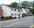
Libanus Road houses, Blackwood
The houses are on the southern section of Libanus Road, which runs west to east, viewed from near the corner of the T-junction with the section of Libanus Road which runs roughly north to south.
Image: © Jaggery
Taken: 24 May 2011
0.08 miles
3
Libanus Primary School, Blackwood
Located on the west side of Libanus Road.
Image: © Jaggery
Taken: 24 May 2011
0.09 miles
4
Divisional Police Headquarters, Blackwood
Part of the Gwent Police Force, viewed across Blackwood Road near the Blackwood/Pontllanfraith boundary.
Image: © Jaggery
Taken: 22 Aug 2013
0.10 miles
5
Divisional Police Headquarters, Blackwood
Image: © John Lord
Taken: 24 Aug 2017
0.12 miles
6
Waste ground, Libanus Road, Blackwood
On the east side of the road, almost opposite a warehouse. http://www.geograph.org.uk/photo/2425787
Image: © Jaggery
Taken: 24 May 2011
0.13 miles
7
Corrugated metal warehouse, Libanus Road, Blackwood
The notice on the building states that it is private property and that no parking of vehicles is allowed on the forecourt.
Image: © Jaggery
Taken: 24 May 2011
0.13 miles
8
Houses at the Libanus Road junction, Blackwood
Viewed across Blackwood Road which becomes High Street, Blackwood beyond the traffic lights.
The left turn is into Libanus Road.
Image: © Jaggery
Taken: 22 Aug 2013
0.14 miles
9
Southern boundary of Blackwood
The view along Blackwood Road (A4048) from the northern edge of Pontllanfraith.
Blackwood (Coed Duon in Welsh), a town with about 23,000 inhabitants, is twinned with Protivin in the Czech Republic. Embarrassingly, the name is misspelt as Protovin on the green sign...
Image: © Jaggery
Taken: 20 Jan 2011
0.14 miles
10
Playing field, Pontllanfraith Leisure Centre
Next to the flat field is Blackwood Police Station. The pylon of Chartist Bridge is beyond.
Image: © M J Roscoe
Taken: 2 Nov 2021
0.15 miles


