1
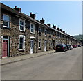
Long row of houses, Tredegar Street, Crosskeys
Looking to the SE from the corner of St Catherine's Court.
Image: © Jaggery
Taken: 23 May 2018
0.02 miles
2
Path leading to bridge across the Sirhowy
The path has passed along the eastern edge of allotments http://www.geograph.org.uk/photo/1892465 and now approaches a footbridge over the Sirhowy river. On the other side of the river is Waunfawr Park.
Image: © Jaggery
Taken: 26 May 2010
0.06 miles
3
Crosskeys Allotments
The view across allotments occupying land between the Sirhowy river and Tredegar Street (in the distance).
Image: © Jaggery
Taken: 26 May 2010
0.06 miles
4
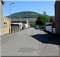
Unnamed side road from Tredegar Terrace to Tredegar Street, Crosskeys
Viewed from the corner of Tredegar Terrace.
Image: © Jaggery
Taken: 23 May 2018
0.09 miles
5
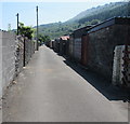
Back lane in Crosskeys
Between the backs of houses in Tredegar Terrace and Tredegar Street.
Viewed from the corner of St Catherine's Court.
Image: © Jaggery
Taken: 23 May 2018
0.09 miles
6
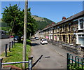
Row of houses, Tredegar Terrace, Crosskeys
This row extends for 60 metres from the southeast end of Tredegar Terrace.
A longer row is in the background.
Image: © Jaggery
Taken: 23 May 2018
0.10 miles
7
C P Construction, Newtown Industrial Estate, Crosskeys
A FOR SALE notice is on the fence on the right in May 2018.
Image: © Jaggery
Taken: 23 May 2018
0.11 miles
8
A467 north of Glenside
Image: © David Smith
Taken: 27 Sep 2021
0.13 miles
9
Confluence of the Sirhowy and Ebbw rivers, Crosskeys
The Sirhowy from centre left joins the Ebbw at the southern edge of Waunfawr Park.
The river flows past the left corner of the photo as the Ebbw River.
Image: © Jaggery
Taken: 10 Apr 2011
0.13 miles
10
Crosskeys Bowls Club pavilion
The pavilion and bowls green are on the south side of Waunfawr Park, close to the confluence http://www.geograph.org.uk/photo/2351055 of the Sirhowy and Ebbw rivers.
Image: © Jaggery
Taken: 10 Apr 2011
0.13 miles


