1
New Road Cwmfelinfach
This shows the view towards the Pioneer Hotel Cwmfelinfach. The pillars and railings to the left mark the front of the Miners Institute, now demolished following a fire. The houses on the right date from around 1912. Near the centre is the direction sign for Ynys Howell, reached down Islwyn Street, named after the Welsh poet buried at Babell Chapel.
Image: © Peter Hutchings
Taken: 15 Jul 2004
0.03 miles
2
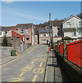
NE end of Western Terrace, Cwmfelinfach
The view from near the corner of King Street http://www.geograph.org.uk/photo/2385081 along Western Terrace towards Maindee Road (B4251). Maindee Road is shown on older maps as the A4048.
The railings are at the perimeter of Cwmfelinfach Primary School. http://www.geograph.org.uk/photo/2385074
Image: © Jaggery
Taken: 7 Apr 2011
0.03 miles
3
Former Bethany Chapel, Cwmfelinfach
Now a private residence, 20 Commercial Road, the building was formerly Bethany Chapel, built in 1912.
Image: © Jaggery
Taken: 14 Mar 2012
0.03 miles
4
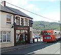
Celtic Print, Cwmfelinfach
The business at 20 Maindee Road provides a full custom framing service as well as canvas, acrylic and photographic prints. A Stagecoach bus on service 56 from Newport, is on its way to Tredegar via Blackwood.
Image: © Jaggery
Taken: 7 Apr 2011
0.03 miles
5
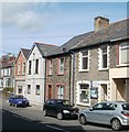
Commercial Road semis, Cwmfelinfach
These semi-detached houses have names but no house numbers. Most of the other houses in Commercial Road are in rows, and have numbers but no names.
Image: © Jaggery
Taken: 14 Mar 2012
0.03 miles
6
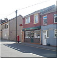
Cwmfelinfach Police Station
The small police station (on the right) at 37 Maindee Road is part of Gwent Police.
Image: © Jaggery
Taken: 7 Apr 2011
0.03 miles
7
Cwmfelinfach post office
Located at 11 Maindee Road.
Image: © Jaggery
Taken: 7 Apr 2011
0.03 miles
8
Electricity substation, Cwmfelinfach
Located at the southern end of Twyn Gwyn Road, near the Commercial Road junction.
Image: © Jaggery
Taken: 14 Mar 2012
0.04 miles
9
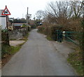
Bends ahead, Twyn Gwyn Road, Cwmfelinfach
A sign warns of bends ahead. On the right is a barrier http://www.geograph.org.uk/photo/2849102 at the edge of a path into woods.
Image: © Jaggery
Taken: 14 Mar 2012
0.04 miles
10
Maindee Road (A4048), Cwmfelinfach
The name Cwmfelinfach comes from a small flannel mill that once stood close to the river.
The building at the road junction is Coronation Buildings named after the coronation of King Edward VII in 1902.
There was also a nearby Coronation Colliery http://www.geograph.org.uk/photo/1797090 .
Image: © Robin Drayton
Taken: 7 Apr 2010
0.04 miles


