IMAGES TAKEN NEAR TO
St. Brides Wentlooge, NEWPORT, NP10 8SR
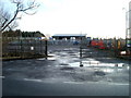
Introduction
This page details the photographs taken nearby to NP10 8SR by members of the Geograph project.
The Geograph project started in 2005 with the aim of publishing, organising and preserving representative images for every square kilometre of Great Britain, Ireland and the Isle of Man.

There are currently over 7.5m images from over14,400 individuals and you can help contribute to the project by visiting https://www.geograph.org.uk
Image Map
Images are licensed for reuse under creativecommons.org/licenses/by-sa/2.0
Notes
- Clicking on the map will re-center to the selected point.
- The higher the marker number, the further away the image location is from the centre of the postcode.
Image Listing (14 Images Found)
Images are licensed for reuse under creativecommons.org/licenses/by-sa/2.0
Image
Details
Distance
1
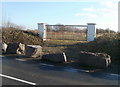
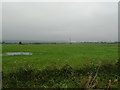
Rocks and gates barring access to empty field, St Bride's Wentlooge
Rocks and locked gates prevent access to what appears to be an empty field on the south side of the B4239. Perhaps there is more to the field than is apparent, or, more likely, there once was something in the field.
Image: © Jaggery
Taken: 8 Jan 2011
0.01 miles
2
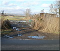
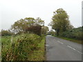
Storage container adjacent to field entrance, St Bride's Wentlooge
The field gate is on the north side of the B4239, opposite the entrance to another field. http://www.geograph.org.uk/photo/2228145
Faintly visible in the distance is higher ground beyond the northern edge of Wentlooge Level.
Image: © Jaggery
Taken: 8 Jan 2011
0.07 miles
3
Royall Windows, St Bride's Wentlooge
Premises of Royall Windows and Conservatories, founded in 1989, located on the south side of the B4239, about 450 metres west of the Hawse Lane junction. http://www.geograph.org.uk/photo/2228078
Image: © Jaggery
Taken: 8 Jan 2011
0.08 miles
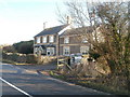
4
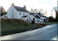
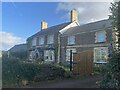
Twm Barlwm, St Bride's Wentlooge
House on the south side of the B4239. The house name is that of the prominent peak Image to the north, visible from much of south Monmouthshire.
Image: © Jaggery
Taken: 8 Jan 2011
0.08 miles
7
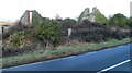
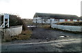
Remains of a building opposite Bluebell Cottage, St Bride's Wentlooge
On the north side of the B4239, opposite Bluebell Cottage. http://www.geograph.org.uk/photo/2228138
Image: © Jaggery
Taken: 8 Jan 2011
0.10 miles
8
Ted Hopkins Tractor Hire, St Bride's Wentlooge
Located at Little Ty-Coch, on the south side of the B4239, roughly midway between the junction with Broadway (from Marshfield) and the Hawse Lane junction.
Founded in 1987, Ted Hopkins Limited is a supplier of agricultural machinery, plant hire services, leisure equipment and related maintenance, parts and on-site servicing.
Image: © Jaggery
Taken: 8 Jan 2011
0.13 miles
9
Bluebell Cottage, St Bride's Wentlooge
Located on the south side of the B4239, about 200 metres west of the Hawse Lane junction. http://www.geograph.org.uk/photo/2228078
Image: © Jaggery
Taken: 8 Jan 2011
0.15 miles