IMAGES TAKEN NEAR TO
Laurel Road, NEWPORT, NP10 8NY
Introduction
This page details the photographs taken nearby to Laurel Road, NP10 8NY by members of the Geograph project.
The Geograph project started in 2005 with the aim of publishing, organising and preserving representative images for every square kilometre of Great Britain, Ireland and the Isle of Man.

There are currently over 7.5m images from over14,400 individuals and you can help contribute to the project by visiting https://www.geograph.org.uk
Image Map
Images are licensed for reuse under creativecommons.org/licenses/by-sa/2.0
Notes
- Clicking on the map will re-center to the selected point.
- The higher the marker number, the further away the image location is from the centre of the postcode.
Image Listing (45 Images Found)
Images are licensed for reuse under creativecommons.org/licenses/by-sa/2.0
Image
Details
Distance
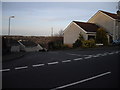
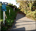
2
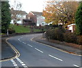
Bend in Laurel Road, Bassaleg
Laurel Road climbs away from crossroads at the Garth Close and Duffryn Close junctions.
Image: © Jaggery
Taken: 27 Oct 2012
0.01 miles
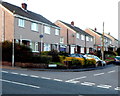
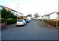
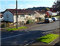
3
Duffryn Close, Bassaleg
Houses on the west side of Duffryn Close viewed across Laurel Road.
Image: © Jaggery
Taken: 27 Oct 2012
0.06 miles
4
Graig Close, Bassaleg
Houses on the west side of Graig Close, viewed across Laurel Road.
Image: © Jaggery
Taken: 27 Oct 2012
0.11 miles
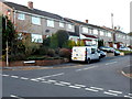
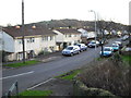
6
Russell Close, Bassaleg
Viewed from Laurel Road. The far end of Russell Close is at the edge
of Garth Wood on the south bank of the River Ebbw.
Image: © Jaggery
Taken: 27 Oct 2012
0.14 miles
8
SW end of Fort View, Bassaleg
Looking in the direction of Laurel Road. A play park http://www.geograph.org.uk/photo/3199492 is a few metres behind the camera.
Image: © Jaggery
Taken: 27 Oct 2012
0.18 miles
9
Path to a Nature Conservation Area, Bassaleg
The path ascends from the north side of Church Crescent towards an area
on the south bank of the River Ebbw that includes Garth Wood.
A Newport City Council notice states that this is a designated area
under the Dogs (Fouling of Land) Act 1996. It is an offence NOT
to clean up after your dog. Maximum penalty £1000.
Image: © Jaggery
Taken: 27 Oct 2012
0.18 miles
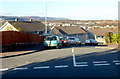
10
Fort View houses, Bassaleg
Steel-framed houses in Fort View, viewed from the Laurel Road end.
The Fort in question is this one. http://www.geograph.org.uk/photo/619433
Image: © Jaggery
Taken: 27 Oct 2012
0.18 miles