IMAGES TAKEN NEAR TO
Nant-y-Moor Close, NEWPORT, NP10 8HH
Introduction
This page details the photographs taken nearby to Nant-y-Moor Close, NP10 8HH by members of the Geograph project.
The Geograph project started in 2005 with the aim of publishing, organising and preserving representative images for every square kilometre of Great Britain, Ireland and the Isle of Man.

There are currently over 7.5m images from over14,400 individuals and you can help contribute to the project by visiting https://www.geograph.org.uk
Image Map
Images are licensed for reuse under creativecommons.org/licenses/by-sa/2.0
Notes
- Clicking on the map will re-center to the selected point.
- The higher the marker number, the further away the image location is from the centre of the postcode.
Image Listing (69 Images Found)
Images are licensed for reuse under creativecommons.org/licenses/by-sa/2.0
Image
Details
Distance
1
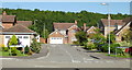
Nant-y-Moor Close, Coedkernew
Viewed from Blacksmiths Way
Image: © Jaggery
Taken: 9 Sep 2009
0.07 miles
2
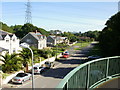
Blacksmiths Way viewed from Coedkernew Footbridge
Viewed from the footbridge http://www.geograph.org.uk/photo/633247 across the A48.
Blacksmiths Way is separated from the M4 motorway to the north by a narrow strip of trees, part of which can be seen in front of the pylon.
Image: © Jaggery
Taken: 9 Sep 2009
0.07 miles
3
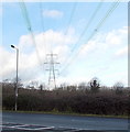
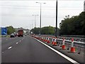
Power lines over the A48, Coedkernew
The pylon is at the edge of the M4 motorway, 180 metres from the camera on the south side of the A48.
Image: © Jaggery
Taken: 21 Dec 2012
0.07 miles
6
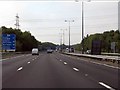
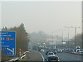
M4 Motorway - half-mile to junction 28, eastbound
Image: © J Whatley
Taken: 22 Sep 2010
0.08 miles
7
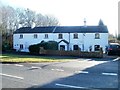
Nantymor Cottages, Coedkernew
Two semi-detached cottages on the south side of Blacksmiths Way, Coedkernew.
Image: © Jaggery
Taken: 8 Jan 2011
0.09 miles
8
A48 east from Coedkernew Footbridge
Looking from the footbridge http://www.geograph.org.uk/photo/633247 towards the roundabout adjacent to Imperial Park.
Image: © Jaggery
Taken: 9 Sep 2009
0.09 miles
9
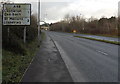
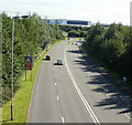
The A48 in Coedkernew one mile east of Castleton
A view west along the A48. A distinctive footbridge http://www.geograph.org.uk/photo/3267779 is in the background.
Image: © Jaggery
Taken: 21 Dec 2012
0.10 miles
10
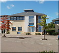
Kilsby & Williams, Newport
Chartered accountants located in Cedar House, Hazell Drive.
Image: © Jaggery
Taken: 25 Sep 2010
0.11 miles