
IMAGES TAKEN NEAR TO
Hatherley Close, NORTHAMPTON, NN6 7GT
Introduction
This page details the photographs taken nearby to Hatherley Close, NN6 7GT by members of the Geograph project.
The Geograph project started in 2005 with the aim of publishing, organising and preserving representative images for every square kilometre of Great Britain, Ireland and the Isle of Man.

There are currently over 7.5m images from over14,400 individuals and you can help contribute to the project by visiting https://www.geograph.org.uk
Image Map
Images are licensed for reuse under creativecommons.org/licenses/by-sa/2.0
Notes
- Clicking on the map will re-center to the selected point.
- The higher the marker number, the further away the image location is from the centre of the postcode.
Image Listing (83 Images Found)
Images are licensed for reuse under creativecommons.org/licenses/by-sa/2.0
Image
Details
Distance
1
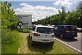
Crick by pass
Traffic is clogged on the A428 trying to get into the Crick Boat Show - the tailback started before the M1 junction.
Image: © Stephen McKay
Taken: 25 May 2014
0.02 miles
3
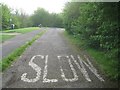
Crick: Former carriageway of the A428
Prior to the building of the Crick Bypass the A428 used to run straight through the town, and out to the east along here. This is a remnant of the former road with the old westbound carriageway on the right now completely vegetated over.
Image: © Nigel Cox
Taken: 8 May 2015
0.09 miles
4

Pasture east of Crick in Northamptonshire
Pasture east of Crick and north of the A428. On the skyline is Crack's Hill.
Image: © Roger D Kidd
Taken: 22 Aug 2013
0.11 miles
5
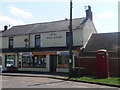
Crick: the post office
The newsagent and post office is situated on Main Road, to the east of the village centre.
Image: © Chris Downer
Taken: 7 May 2013
0.12 miles
6
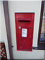
Crick: postbox № NN6 232
This George VI-reign postbox is set into the wall of Image
Image: © Chris Downer
Taken: 7 May 2013
0.12 miles
7

Bridleway north-east of Crick in Northamptonshire
The bridleway crosses fields between the A428 roundabout east of Crick and Yelvertoft village.
Image: © Roger D Kidd
Taken: 22 Aug 2013
0.12 miles
8
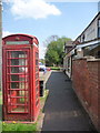
Crick: a red phone box
This traditional K6 telephone box stands just a couple of yards from Image, on Main Road.
Image: © Chris Downer
Taken: 7 May 2013
0.13 miles
9
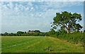
Pasture and bridleway north-east of Crick in Northamptonshire
The bridleway crosses fields between the A428 roundabout east of Crick and Yelvertoft village. On the skyline left of centre is Crack's Hill.
Image: © Roger D Kidd
Taken: 22 Aug 2013
0.13 miles
10
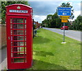
Telephone box on the Main Road of Crick
Image: © Mat Fascione
Taken: 25 Jul 2015
0.13 miles