IMAGES TAKEN NEAR TO
Balliol Road, BRACKLEY, NN13 6LY
Introduction
This page details the photographs taken nearby to Balliol Road, NN13 6LY by members of the Geograph project.
The Geograph project started in 2005 with the aim of publishing, organising and preserving representative images for every square kilometre of Great Britain, Ireland and the Isle of Man.

There are currently over 7.5m images from over14,400 individuals and you can help contribute to the project by visiting https://www.geograph.org.uk
Image Map
Images are licensed for reuse under creativecommons.org/licenses/by-sa/2.0
Notes
- Clicking on the map will re-center to the selected point.
- The higher the marker number, the further away the image location is from the centre of the postcode.
Image Listing (25 Images Found)
Images are licensed for reuse under creativecommons.org/licenses/by-sa/2.0
Image
Details
Distance
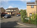
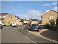
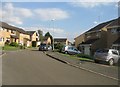
3
South-east along Rose Drive, Brackley
The mini-roundabout is either on Humphries Drive or Somerville Road - the maps are ambiguous on this. The grid references are, however, spot on.
Image: © Brian Robert Marshall
Taken: 2 Jun 2010
0.16 miles
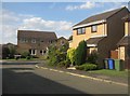
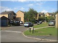
4
Humphries Drive, Brackley
Humphries Drive, Brackley
Image: © Snidge
Taken: 9 Mar 2007
0.17 miles
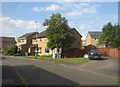
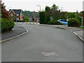
8
Humphries Drive, Brackley
Humphries Drive might also be known as Somerville Road. It depends which map you look at. I'll go with the former. The lamppost at the left is 3 metres north of the southern gridline of this square.
Image: © Brian Robert Marshall
Taken: 2 Jun 2010
0.18 miles
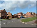
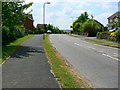
10
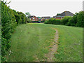
Public open space, Brackley
There is a triangular area of open space on the western edge of the 1980s/90s housing area on the western side of Brackley. It lies between Price's Way to the left and Rose Drive.
Image: © Brian Robert Marshall
Taken: 2 Jun 2010
0.19 miles