
IMAGES TAKEN NEAR TO
Church Street, NOTTINGHAM, NG9 1FH
Introduction
This page details the photographs taken nearby to Church Street, NG9 1FH by members of the Geograph project.
The Geograph project started in 2005 with the aim of publishing, organising and preserving representative images for every square kilometre of Great Britain, Ireland and the Isle of Man.

There are currently over 7.5m images from over14,400 individuals and you can help contribute to the project by visiting https://www.geograph.org.uk
Image Map
Images are licensed for reuse under creativecommons.org/licenses/by-sa/2.0
Notes
- Clicking on the map will re-center to the selected point.
- The higher the marker number, the further away the image location is from the centre of the postcode.
Image Listing (1259 Images Found)
Images are licensed for reuse under creativecommons.org/licenses/by-sa/2.0
Image
Details
Distance
1
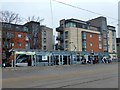
Beeston Centre tram stop
On the south western leg of the Nottingham Extress Transit network
Image: © Graham Hogg
Taken: 20 Mar 2018
0.00 miles
2
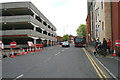
Temporary bus stops on Styring Street
The south side of the Bus Station is closed (see the cones on the left) for the demolition of the multi-storey car park to make way for the Beeston Town stop of the NET tram.
Image: © David Lally
Taken: 9 May 2012
0.00 miles
3
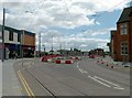
Beeston Transport Interchange
Looking in from the west. There is now free pedestrian access, although the Interchange is not yet in use.
Image: © Alan Murray-Rust
Taken: 20 May 2015
0.01 miles
4
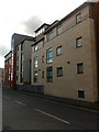
Apartments on Styring Street, Beeston
Built in 2003-4
Image: © David Lally
Taken: 7 Apr 2009
0.01 miles
5
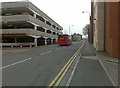
Styring Street, Beeston
This road is a dead-end for all except buses which access the bus station from here. The Chilwell bus seen here will have entered the station from the Station Road end.
Cars use the street to-and-from the multi-storey car park on the left. The entrance is through the nearest arch, with the sign above.
The go-ahead was given for the Phase two extension to the NET tram system this week. If that goes ahead with the currently preferred route through Beeston Town Centre then the tracks will run along here, and a slice will be removed from the car park.
Image: © David Lally
Taken: 3 Apr 2009
0.01 miles
6
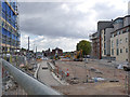
Beeston Transport interchange
Looking south
Image: © Alan Murray-Rust
Taken: 31 Aug 2014
0.01 miles
7
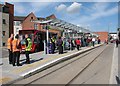
Waiting for a tram at Beeston Centre on opening day
Expectant passengers waiting for a city-bound tram on the first morning of operation on the two new lines, to Beeston and Chilwell and to Clifton.
Image: © John Sutton
Taken: 25 Aug 2015
0.01 miles
8
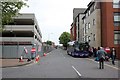
Styring Street
Some of the stops from Beeston Bus Station have been located here. The multi-storey car park is now fully fenced in for demolition work, compared with http://www.geograph.org.uk/photo/2950517
Image: © Alan Murray-Rust
Taken: 21 Jun 2012
0.01 miles
9
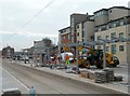
Beeston Transport Interchange
New shelter being erected on the Nottingham-bound platform. Trams will stop on this side and there are bus bays on the other side, providing easy connections.
Image: © Alan Murray-Rust
Taken: 20 Mar 2015
0.01 miles
10
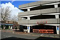
The Beeston multi-storey car park
This was the former entrance and exit from the car park on Styring Street. Now closed and awaiting demolition to make way for the NET tram.
Image: © David Lally
Taken: 11 Apr 2012
0.01 miles