1
Southwold Primary School, Radford
Southwold Primary School was built in 1968 to serve the local council housing. Many people in the area then worked for Raleigh or Players. Formerly it was known as Wollaton Board School and was located where the University's Jubilee Campus is now sited. The school now serves a rich and diverse community with a range of cultures.
Image: © Sally Holmes
Taken: 1 Aug 2006
0.03 miles
2
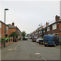
Kennington Road, Radford
Kennington Road is part of the catchment area for Southwold Primary School. It is a cul-de-sac, with a railway line running just beyond the furthest most houses.
Image: © Sally Holmes
Taken: 1 Aug 2006
0.04 miles
3
Marchwood Close, off Wollaton Road
Typical Nottingham council houses.
Image: © John Sutton
Taken: 20 Nov 2009
0.05 miles
4
Western Boulevard
The Nottingham Ring Road just north of Crown Island
Image: © Alan Murray-Rust
Taken: 19 Oct 2008
0.09 miles
5
Nottingham - NG7 (Lenton)
These Imperial Tobacco Company warehouses on Wollaton Road (A609) were originally owned by Players. Although John Player (1839-84) was born in Saffron Walden, Essex he began his career by purchasing a shop on Beastmarket Hill NG1 and selling seeds and fertiliser. Later he started to sell loose tobacco to farmers and very soon his tobacco sales were proving much more lucrative. By 1871 he was registered as a tobacconist and was employing one man and three boys. In 1877, he bought a small tobacco factory at 45, Broadmarsh. By 1939 his third factory on Radford Boulevard had been constructed along with these bonded tobacco warehouses. Until their demolition, 2016-22, the latter had the capacity to store 20,000 tons of tobacco leaf. However, the site, including these buildings, was acquired by the University in 2016 for a 280-room hall of residence.
Image: © David Hallam-Jones
Taken: 5 May 2012
0.09 miles
6
Newland Close, Wollaton
Newland Close runs parallel with Western Boulevard (part of Nottingham's ring road) near the north eastern edge of Wollaton. However, while the latter road rises to cross the Radford Junction to Trowell Junction railway line on a bridge, Newland Close remains level, and comes to an abrupt end where it meets the railway boundary fence (just visible in the distance). The terraces of four houses, with semihexagonal porches providing access to the middle dwellings, are typical of pre Second World War council estates in Nottingham, as is the circular street sign visible on the right. This estate is effectively cut in half by Western Boulevard, and is bounded to the north and east by the railway, to the south by Wollaton Road, and to the west by the now obliterated course of the Nottingham Canal.
Image: © Richard Vince
Taken: 1 Feb 2013
0.10 miles
7
Re-roofing in Kennington Road
A drab and misty September morning in an area of Radford once known as Sodom, as older Nottinghamians may recall. Many of the Victorian terraces at the Wollaton Road end of this area were demolished in the 1970s, but the council houses built in the late 1930s remain.
Image: © John Sutton
Taken: 16 Sep 2014
0.10 miles
8
Radford: St Paul's Street
Many of the Victorian terraced houses at the Wollaton Road end of Kennington and Canterbury Roads were demolished in the 1970s, but this side of St Paul's Street remains. To the left, roofers are working on the council houses built in the late 1930s. This area, photographed on a grey September morning, was once known as Sodom, as older Nottinghamians may remember.
Image: © John Sutton
Taken: 16 Sep 2014
0.10 miles
9
Player's Bonded Warehouse coming down
One of the three blocks of Player’s Bonded Warehouse has come down. For comparison, see
Image], taken from more or less the same spot just after demolition began in June 2017.
Image: © John Sutton
Taken: 24 Aug 2017
0.10 miles
10
Along Wollaton Road
Looking towards the city from a pedestrian refuge near the entrance to Nottingham University's Melton Hall. One of the three blocks of Player's Bonded Warehouse has been demolished and the other two will follow. The site will be developed as part of the University's Jubilee Campus.
Image: © John Sutton
Taken: 24 Aug 2017
0.10 miles


