Radford: St Paul's Street
Introduction
The photograph on this page of Radford: St Paul's Street by John Sutton as part of the Geograph project.
The Geograph project started in 2005 with the aim of publishing, organising and preserving representative images for every square kilometre of Great Britain, Ireland and the Isle of Man.

There are currently over 7.5m images from over 14,400 individuals and you can help contribute to the project by visiting https://www.geograph.org.uk
Radford: St Paul's Street
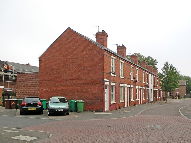
Image: © John Sutton Taken: 16 Sep 2014
Many of the Victorian terraced houses at the Wollaton Road end of Kennington and Canterbury Roads were demolished in the 1970s, but this side of St Paul's Street remains. To the left, roofers are working on the council houses built in the late 1930s. This area, photographed on a grey September morning, was once known as Sodom, as older Nottinghamians may remember.
Images are licensed for reuse under creativecommons.org/licenses/by-sa/2.0
Image Location


Leaflet Map data © OpenStreetMap
Latitude
52.956482
Longitude
-1.187058