IMAGES TAKEN NEAR TO
Darley Road, NOTTINGHAM, NG7 5NS
Introduction
This page details the photographs taken nearby to Darley Road, NG7 5NS by members of the Geograph project.
The Geograph project started in 2005 with the aim of publishing, organising and preserving representative images for every square kilometre of Great Britain, Ireland and the Isle of Man.

There are currently over 7.5m images from over14,400 individuals and you can help contribute to the project by visiting https://www.geograph.org.uk
Image Map
Images are licensed for reuse under creativecommons.org/licenses/by-sa/2.0
Notes
- Clicking on the map will re-center to the selected point.
- The higher the marker number, the further away the image location is from the centre of the postcode.
Image Listing (211 Images Found)
Images are licensed for reuse under creativecommons.org/licenses/by-sa/2.0
Image
Details
Distance
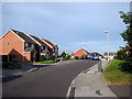
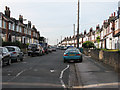
1
Darley Road
Leading down from Bobbers Mill Road to Plantation Side and Darley Avenue.
Image: © John Sutton
Taken: 24 Sep 2009
0.01 miles
2
Plantation Side - 2
The corner of Plantation Side - now a suburban backstreet - and Darley Avenue.
Image: © John Sutton
Taken: 12 Aug 2009
0.04 miles
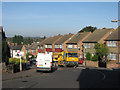
3
Bobbers Mill: along Chadwick Road
Looking from the Darley Road end towards Alfreton Road on a gloomy September morning. These houses were built in the late 1930s as Nottingham expanded westwards beyond its Victorian edge. The builders may not have envisaged the addition of a Doric colonnade to the front of the house on the left.
Image: © John Sutton
Taken: 12 Sep 2018
0.04 miles
4
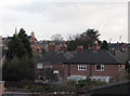
Bobbers Mill Panorama
This zoom view from the railway footbridge shows the houses of Darley Avenue in the foreground and beyond them the roofs of Chadwick Road (right) and Darley Road (left). St Stephen's Church on Bobbers Mill Road is on the horizon on the left and two of the Radford football ground's floodlights on the right. When I was a boy, this view was blocked by Bobbers Mill, long demolished.
Image: © John Sutton
Taken: 20 Nov 2009
0.05 miles
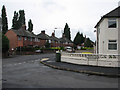
5
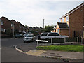
The corner of Meadow Brown Road and Plantation Side
Image: © John Sutton
Taken: 25 Sep 2009
0.05 miles
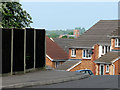
6
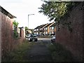
Plantation Side
The Darley Road end of the twitchel which winds through the former Lindley & Lindley site. The houses ahead are on the middle part of Plantation Side, which is a road.
Image: © John Sutton
Taken: 13 Sep 2012
0.05 miles
7
An overcast morning on Plantation Side
The southern end of Plantation Side (straight ahead) is a narrow twitchel between high brick walls - and once, further on, the buildings of Lindley & Lindley's hosiery works. The backs of houses on Chadwick Road are on the skyline. Like those of Darley Avenue on the right, they were built in the 1930s.
Image: © John Sutton
Taken: 11 Apr 2013
0.05 miles
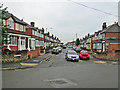
8
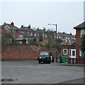
Chadwick Road
The north end, seen from near the junction with Darley Road.
Image: © John Sutton
Taken: 25 Sep 2009
0.05 miles
9
From Church to Church
Standing outside St Stephen's Church on Bobbers Mill Road and looking due west, you can see St Margaret's Church about a mile away on Aspley Lane. The houses in the foreground are on Field Maple Drive, on the slope of the Leen Valley.
Image: © John Sutton
Taken: 19 May 2010
0.05 miles