
IMAGES TAKEN NEAR TO
Alderton Road, NOTTINGHAM, NG5 6DX
Introduction
This page details the photographs taken nearby to Alderton Road, NG5 6DX by members of the Geograph project.
The Geograph project started in 2005 with the aim of publishing, organising and preserving representative images for every square kilometre of Great Britain, Ireland and the Isle of Man.

There are currently over 7.5m images from over14,400 individuals and you can help contribute to the project by visiting https://www.geograph.org.uk
Image Map
Images are licensed for reuse under creativecommons.org/licenses/by-sa/2.0
Notes
- Clicking on the map will re-center to the selected point.
- The higher the marker number, the further away the image location is from the centre of the postcode.
Image Listing (35 Images Found)
Images are licensed for reuse under creativecommons.org/licenses/by-sa/2.0
Image
Details
Distance
1
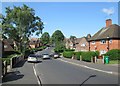
Alderton Road
Looking down the hill towards the corner of Archdale Road. This is a typical Nottingham Council Estate with substantial brick houses in Garden City style.
Image: © John Sutton
Taken: 25 Jun 2013
0.01 miles
2
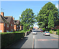
Edwards Lane Estate: Alderton Road
A typical Nottingham Council Estate, planned in the late 1930s, with houses in the Garden City style. This is the view up the hill towards Edwards Lane.
Image: © John Sutton
Taken: 25 Jun 2013
0.06 miles
3
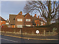
Corner semis on Edwards Lane Council Estate
This design appears to have been used across many Nottingham council estates between the mid-1920s through to the late 1940s (as here). Usually they occupy corner plots at junctions, with the two houses characteristically belonging to different streets. Earlier examples may be pebble-dashed or tile-hung rather than having exposed brickwork.
Image: © SK53
Taken: 4 Jan 2011
0.09 miles
4
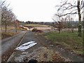
Demolition rubble on site of Haywood School
Haywood School was demolished not long after it was closed.
Currently (2013) there are informal planning guidelines for it to be redeveloped for housing (see Evening Post story http://www.nottinghampost.com/Plans-100-family-homes-Sherwood-school-site-step/story-16559833-detail/story.html ).
The Southern part of the site is on the line of Nottingham Suburban Railway.
Image: © SK53
Taken: 4 Jan 2011
0.09 miles
5
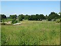
Former course of The Back Line
The Great Northern Railway line from Colwick to Ilkeston and Derby was built in the 1870s to carry coal from the Erewash Valley. It was known as The Back Line as it went the back way, in a huge loop round the east and north of Nottingham, in contrast to the more direct Midland line. The section east of Basford closed in 1960 when Mapperley Tunnel was deemed unsafe. This is the view towards Edwards Lane from Peggy's Park (see Image]).
Image: © John Sutton
Taken: 25 Jun 2013
0.10 miles
6
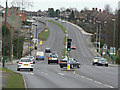
Oxclose Lane
East of Edwards Lane, the B6004 becomes Oxclose Lane and a dual carriageway. It is part of a major orbital route round north Nottingham.
Image: © Alan Murray-Rust
Taken: 15 Mar 2009
0.11 miles
7
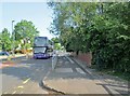
The 89 bus on Edwards Lane
The bus into town may be of interest to bus enthusiasts, but I had come to see the red-brick wall on the right, once the parapet of the bridge over the Great Northern Railway line from Nottingham to Derby, known as The Back Line as it looped round the east and north of the city instead of taking the direct route to the west chosen forty years earlier by the Midland Railway. This section of The Back Line closed in 1960.
Image: © John Sutton
Taken: 25 Jun 2013
0.12 miles
8
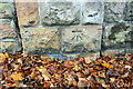
Benchmark on wall pier of Edwards Lane
Ordnance Survey cut mark benchmark described on the Bench Mark Database at http://www.bench-marks.org.uk/bm91947
Image: © Roger Templeman
Taken: 29 Nov 2017
0.14 miles
9
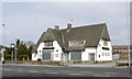
The Oxclose
A once popular pub serving the Bestwood estate. Now boarded up and looking forlorn.
Image: © Mick Garratt
Taken: 3 May 2008
0.14 miles
10
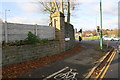
Edwards Lane at Arnold Road junction
There is an OS benchmark Image on the wall pier left of the road name sign
Image: © Roger Templeman
Taken: 29 Nov 2017
0.14 miles