IMAGES TAKEN NEAR TO
Longmead Drive, NOTTINGHAM, NG5 6DW
Introduction
This page details the photographs taken nearby to Longmead Drive, NG5 6DW by members of the Geograph project.
The Geograph project started in 2005 with the aim of publishing, organising and preserving representative images for every square kilometre of Great Britain, Ireland and the Isle of Man.

There are currently over 7.5m images from over14,400 individuals and you can help contribute to the project by visiting https://www.geograph.org.uk
Image Map
Images are licensed for reuse under creativecommons.org/licenses/by-sa/2.0
Notes
- Clicking on the map will re-center to the selected point.
- The higher the marker number, the further away the image location is from the centre of the postcode.
Image Listing (28 Images Found)
Images are licensed for reuse under creativecommons.org/licenses/by-sa/2.0
Image
Details
Distance
1
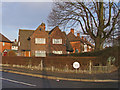
Corner semis on Edwards Lane Council Estate
This design appears to have been used across many Nottingham council estates between the mid-1920s through to the late 1940s (as here). Usually they occupy corner plots at junctions, with the two houses characteristically belonging to different streets. Earlier examples may be pebble-dashed or tile-hung rather than having exposed brickwork.
Image: © SK53
Taken: 4 Jan 2011
0.07 miles
2
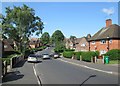
Alderton Road
Looking down the hill towards the corner of Archdale Road. This is a typical Nottingham Council Estate with substantial brick houses in Garden City style.
Image: © John Sutton
Taken: 25 Jun 2013
0.11 miles
3
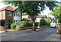
Bedale Road, 2013
Detached houses dating from the late 1930s and very typical of Nottingham's suburbs. Compare this picture with Image
Image: © John Sutton
Taken: 25 Jun 2013
0.12 miles
4
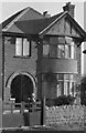
Bedale Road, 1949
This picture was taken by the then owner of the house, my uncle Harry Lees, a headmaster. It shows his mother, Helen, who had been widowed since the 1890s and lived with him until her death in the early 1950s. Compare this picture with Image
Image: © Sutton family album
Taken: Unknown
0.13 miles
5
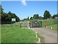
Sherwood/Daybrook: Peggy's Park
The gate, designed by young people from Edwards Lane Community Centre, reflects the place's relatively recent past, as part of the Great Northern Railway's Nottingham-Derby railway, known as the Back Line. An information board gives a good potted history of the line, with pictures.
Though in the Sherwood area of the City of Nottingham, the park is not far from the site of Daybrook Station.
Image: © John Sutton
Taken: 25 Jun 2013
0.14 miles
6
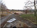
Demolition rubble on site of Haywood School
Haywood School was demolished not long after it was closed.
Currently (2013) there are informal planning guidelines for it to be redeveloped for housing (see Evening Post story http://www.nottinghampost.com/Plans-100-family-homes-Sherwood-school-site-step/story-16559833-detail/story.html ).
The Southern part of the site is on the line of Nottingham Suburban Railway.
Image: © SK53
Taken: 4 Jan 2011
0.14 miles
7
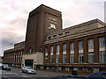
Home Brewery buildings, Daybrook
Now council offices
Image: © Q
Taken: 14 Jun 2005
0.14 miles
8
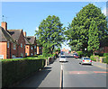
Edwards Lane Estate: Alderton Road
A typical Nottingham Council Estate, planned in the late 1930s, with houses in the Garden City style. This is the view up the hill towards Edwards Lane.
Image: © John Sutton
Taken: 25 Jun 2013
0.16 miles
9
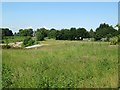
Former course of The Back Line
The Great Northern Railway line from Colwick to Ilkeston and Derby was built in the 1870s to carry coal from the Erewash Valley. It was known as The Back Line as it went the back way, in a huge loop round the east and north of Nottingham, in contrast to the more direct Midland line. The section east of Basford closed in 1960 when Mapperley Tunnel was deemed unsafe. This is the view towards Edwards Lane from Peggy's Park (see Image]).
Image: © John Sutton
Taken: 25 Jun 2013
0.16 miles