1
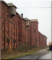
Malting Pavilions, Sleaford, Lincs.
The pavilions seen here through the security fencing and gates. In the years since the buildings ceased to be used for their original purpose, they have been used for chicken rearing and vegetable processing but they are currently standing unused.
Image: © David Hallam-Jones
Taken: 29 Nov 2014
0.03 miles
2
Malting Pavilions, Sleaford, Lincs.
By the turn of the C20th, Sleaford was considered well placed for a malting complex on this scale. It was close to extensive fields of barley, could rely upon a seasonal workforce for the summer harvest, the area was served by a plentiful water supply thanks to an artesian well that had been dug at the end of C19th and the railway was close by. Covering a geographical area of over 13 acres and benefiting from some 500,000 sq ft of floor space these maltings took 6 years to build (1901-06) and cost around £350,000. By the end of WWII however, with the malt industry in a state of continuing decline, production finally ceased in 1959. The infrastructure had become out-dated and too costly to maintain. In 1973 the Sleaford Bass Maltings were purchased by a local firm for chicken rearing and vegetable processing. However, its use for chicken rearing ended in the 1990s when approval was given for residential development of adjacent land.
Image: © David Hallam-Jones
Taken: 29 Nov 2014
0.04 miles
3
Approach to former maltings, Sleaford
Lined with offices and other ancillary buildings formerly associated with the maltings (behind the camera). See
Image
Image: © Stephen Richards
Taken: 1 Jun 2014
0.04 miles
4
Bass Maltings, Sleaford
The Maltings is a Grade II* listed complex built between 1901 and 1907 for Bass, Ratcliff and Cretton Ltd.
The central block with its engine house and water tower is flanked on each side by four six-storey malthouses. It has a total floor space of 500,000 square feet, and occupies a site of 13.3 acres with a frontage almost 1,000 ft long.
The Engine House was built first, followed by the Malthouses. The whole complex, including the Houses, cost £350,000, and had the capacity to produce 60,000 quarters of malt in one season.
Sixteen malthouses were originally planned, with the second group located immediately to the south of the existing group.
Maltings operations ceased in 1959 due to the advent of new malting processes and the size and inefficiency of the Malthouses.
The buildings were subsequently used for poultry farming and vegetable processing. They are now all empty.
The fire that gutted three of the malthouses happened way back in 1976.
In January 2009, applications for Planning and Listed Building Consent were registered by North Kesteven District Council, including the change of use to provide 204 residential dwellings, healthcare and community facilities, retail and restaurant floor space, offices and associated open space and car parking.
In addition 24 new houses are proposed to the east of the Maltings. Permission was granted in 2011, but included a section 106 (road improvement) notice. As yet the two local councils have failed to agree on this road so work has not started.
Image: © J.Hannan-Briggs
Taken: 13 Jan 2013
0.04 miles
5
Bass Maltings Site, Sleaford, Lincs.
The main link between the malting pavilions - behind the photographer - and the main gates (the entrance/exit). On the left is the weighbridge and on the right - identifiable by the security fencing - is one of the former stable and office blocks. Some of the houses built for managers and their families are also visible on the right. Mareham Lane lies less than a minute in the distance.
Image: © David Hallam-Jones
Taken: 29 Nov 2014
0.04 miles
6
Bass maltings and former Advanta Seeds site, Sleaford: aerial 2020 (1)
Image: © Simon Tomson
Taken: 4 Jan 2020
0.05 miles
7
Bass Maltings
Detail of the pavilions at Bass Maltings http://www.geograph.org.uk/photo/2238213
Image: © Richard Croft
Taken: 18 Jan 2011
0.05 miles
8
Rail tracks at Sleaford Maltings
Image: © Betty Longbottom
Taken: 7 Sep 2009
0.06 miles
9
Sleaford Maltings
Image: © Betty Longbottom
Taken: 7 Sep 2009
0.06 miles
10
Workers' Housing - Sleaford Maltings
Image: © Betty Longbottom
Taken: 7 Sep 2009
0.07 miles


