Bass Maltings Site, Sleaford, Lincs.
Introduction
The photograph on this page of Bass Maltings Site, Sleaford, Lincs. by David Hallam-Jones as part of the Geograph project.
The Geograph project started in 2005 with the aim of publishing, organising and preserving representative images for every square kilometre of Great Britain, Ireland and the Isle of Man.

There are currently over 7.5m images from over 14,400 individuals and you can help contribute to the project by visiting https://www.geograph.org.uk
Bass Maltings Site, Sleaford, Lincs.
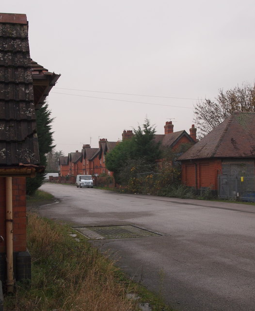
Image: © David Hallam-Jones Taken: 29 Nov 2014
The main link between the malting pavilions - behind the photographer - and the main gates (the entrance/exit). On the left is the weighbridge and on the right - identifiable by the security fencing - is one of the former stable and office blocks. Some of the houses built for managers and their families are also visible on the right. Mareham Lane lies less than a minute in the distance.
Images are licensed for reuse under creativecommons.org/licenses/by-sa/2.0
Image Location
Latitude
52.993587
Longitude
-0.40386