IMAGES TAKEN NEAR TO
Sempringham, SLEAFORD, NG34 0LA
Introduction
This page details the photographs taken nearby to NG34 0LA by members of the Geograph project.
The Geograph project started in 2005 with the aim of publishing, organising and preserving representative images for every square kilometre of Great Britain, Ireland and the Isle of Man.

There are currently over 7.5m images from over14,400 individuals and you can help contribute to the project by visiting https://www.geograph.org.uk
Image Map
Images are licensed for reuse under creativecommons.org/licenses/by-sa/2.0
Notes
- Clicking on the map will re-center to the selected point.
- The higher the marker number, the further away the image location is from the centre of the postcode.
Image Listing (11 Images Found)
Images are licensed for reuse under creativecommons.org/licenses/by-sa/2.0
Image
Details
Distance
1
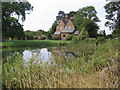
Sempringham House Farm, Sempringham, Lincs
– view from Neslam Road.
Image: © Rodney Burton
Taken: 5 Aug 2006
0.00 miles
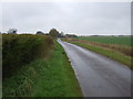
2
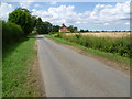
Approaching Sempringham House Farm
This is Neslam Road after leaving Neslam Fen as it approaches Sempringham House Farm. The main farm buildings are out of sight to the left of the road.
Image: © Marathon
Taken: 28 Jul 2014
0.04 miles
3
The approach to Sempringham House Farm along Neslam Road
This is Neslam Road after leaving Neslam Fen as it approaches Sempringham House Farm. The main farm buildings are out of sight to the left of the road. As usual with these Fenland roads there is a drainage ditch on at least one side of the road, in this case on the north side.
Image: © Marathon
Taken: 28 Jul 2014
0.08 miles
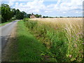
4
Ditch next to Neslam Road
This is Neslam Road near Sempringham House Farm. As usual with these Fenland roads there is a drainage ditch on at least one side of the road, in this case on the north side.
Image: © Marathon
Taken: 28 Jul 2014
0.16 miles
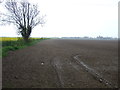
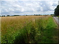
8
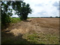
The line of the former Bourne & Sleaford Railway
The Bourne & Sleaford Railway arose out of a proposal by the Great Eastern Railway to open a line from Cambridge to York, via Essendine, Bourne, Sleaford and Lincoln. Parliament though refused to authorise it. The Great Northern Railway had already proposed the Bourne to Sleaford section and opened this in 1872.
The line closed to passengers in 1930, although the section from Bourne through Rippingale to Billingborough remained open for goods until 1964. This section of line had therefore been closed 50 years when I photographed it. The line followed the left hand side of this field on its way to Rippingale - see http://www.geograph.org.uk/photo/3966050
Image: © Marathon
Taken: 28 Jul 2014
0.24 miles
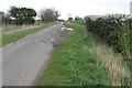
9
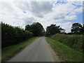
Neslam Road
The house on the right was a gatehouse on the former railway from Bourne to Sleaford.
Image: © Jonathan Thacker
Taken: 2 Jul 2019
0.24 miles