IMAGES TAKEN NEAR TO
Buckminster, GRANTHAM, NG33 5BH
Introduction
This page details the photographs taken nearby to NG33 5BH by members of the Geograph project.
The Geograph project started in 2005 with the aim of publishing, organising and preserving representative images for every square kilometre of Great Britain, Ireland and the Isle of Man.

There are currently over 7.5m images from over14,400 individuals and you can help contribute to the project by visiting https://www.geograph.org.uk
Image Map
Images are licensed for reuse under creativecommons.org/licenses/by-sa/2.0
Notes
- Clicking on the map will re-center to the selected point.
- The higher the marker number, the further away the image location is from the centre of the postcode.
Image Listing (23 Images Found)
Images are licensed for reuse under creativecommons.org/licenses/by-sa/2.0
Image
Details
Distance
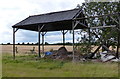
1
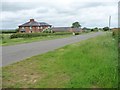
Aerodrome Farm
Buckminster Aerodrome [not the nearby Saltby] was used between 1916 and 1919 and is long-gone. The farm was built 20 or 30 years before the airfield, but became named after it.
Image: © Christine Johnstone
Taken: 14 Jun 2013
0.01 miles
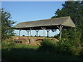
2
Aerodrome Farm
Aerodrome Farm takes its name from the WW1 grass runway aerodrome known as RAF Buckminster. The farm buildings date back to 1897, however.
RAF Buckminster was opened in 1916 and closed in 1919. See http://www.raf-lincolnshire.info/buckminster/buckminster.htm
Image: © Bob Harvey
Taken: 28 Aug 2016
0.01 miles
3
Disused field gates, west of Aerodrome Farm
On the north-west side of Crabtree Lane.
Image: © Christine Johnstone
Taken: 14 Jun 2013
0.03 miles
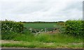
4
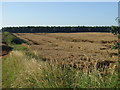
Farmland south of Aerodrome Farm
On the south-east side of Crabtree Road.
Image: © Christine Johnstone
Taken: 14 Jun 2013
0.04 miles
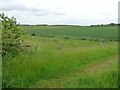
5
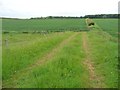
Farm track south of Aerodrome Farm
On the south-east side of Crabtree Road.
Image: © Christine Johnstone
Taken: 14 Jun 2013
0.05 miles
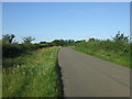
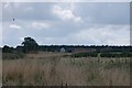
10
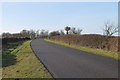
Crabtree Road near Aerodrome Farm
The water tower is in the next square.
Image: © J.Hannan-Briggs
Taken: 24 Jan 2015
0.08 miles