IMAGES TAKEN NEAR TO
Elms View, GRANTHAM, NG31 8LR
Introduction
This page details the photographs taken nearby to Elms View, NG31 8LR by members of the Geograph project.
The Geograph project started in 2005 with the aim of publishing, organising and preserving representative images for every square kilometre of Great Britain, Ireland and the Isle of Man.

There are currently over 7.5m images from over14,400 individuals and you can help contribute to the project by visiting https://www.geograph.org.uk
Image Map
Images are licensed for reuse under creativecommons.org/licenses/by-sa/2.0
Notes
- Clicking on the map will re-center to the selected point.
- The higher the marker number, the further away the image location is from the centre of the postcode.
Image Listing (41 Images Found)
Images are licensed for reuse under creativecommons.org/licenses/by-sa/2.0
Image
Details
Distance
1
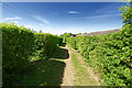
Bassets Close Footpath
Bassetts Close footpath viewed from the footpath junction at the top of the hill. Runs behind houses on Elms View on the right.
Image: © Richard Bamford
Taken: 25 May 2020
0.05 miles
2
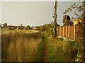
Footpath behind the house
One is tempted to speculate when the land to the left will be built on.
Image: © Anthony Vosper
Taken: 25 Oct 2011
0.06 miles
3
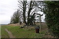
Footpath and byway junction at the end of Church Lane, Great Gonerby
The unofficial finger points down 'Skinny Winton's Lane'.
Image: © Tim Heaton
Taken: 30 Dec 2017
0.09 miles
4
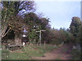
Footpath junction behind the houses
Slowly the farm land is being absorbed by new houses.
Image: © Anthony Vosper
Taken: 25 Oct 2011
0.10 miles
5
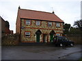
Spring End Cottages
Built on the site of the Wesleyan Methodist chapel of 1835.
Image: © Anthony Vosper
Taken: 24 Feb 2011
0.12 miles
6
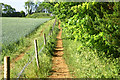
Footpath near Gonerby
Footpath alongside field near Gonerby (near Elms View)
Image: © Richard Bamford
Taken: 30 May 2020
0.13 miles
7
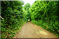
Church Lane
View from the path crossing at the top of the hill at Gonerby down the track that becomes Church Lane.
Image: © Richard Bamford
Taken: 6 Jun 2020
0.14 miles
8
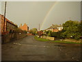
Somewhere over the rainbow
Pond Street, Great Gonerby. The cottages on the left stand on the site of a former Methodist chapel.
Image: © Anthony Vosper
Taken: 25 Oct 2011
0.15 miles
9
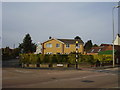
The Pond
At the junction of the aptly named Pond Street and High Street.
A plaque commemorates the now dried up pond.
There was a tradition for gathering mud and stones from here and pelting the church clock with them.
Image: © Anthony Vosper
Taken: 30 Oct 2009
0.16 miles