
IMAGES TAKEN NEAR TO
Russell Read Almshouses, GRANTHAM, NG31 6RH
Introduction
This page details the photographs taken nearby to Russell Read Almshouses, NG31 6RH by members of the Geograph project.
The Geograph project started in 2005 with the aim of publishing, organising and preserving representative images for every square kilometre of Great Britain, Ireland and the Isle of Man.

There are currently over 7.5m images from over14,400 individuals and you can help contribute to the project by visiting https://www.geograph.org.uk
Image Map
Images are licensed for reuse under creativecommons.org/licenses/by-sa/2.0
Notes
- Clicking on the map will re-center to the selected point.
- The higher the marker number, the further away the image location is from the centre of the postcode.
Image Listing (687 Images Found)
Images are licensed for reuse under creativecommons.org/licenses/by-sa/2.0
Image
Details
Distance
2
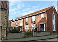
Dorothy Brownlow House, Castlegate
A block of 8 almshouses built in 1968 to replace almshouses in High Street.
Image: © Alan Murray-Rust
Taken: 15 Feb 2017
0.02 miles
3
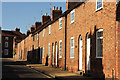
Bluegate
Early 19th century houses on Bluegate
Image: © Richard Croft
Taken: 13 Feb 2014
0.02 miles
4
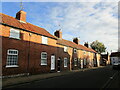
Terraced cottages, Bluegate, Grantham
Image: © Jonathan Thacker
Taken: 9 Nov 2022
0.02 miles
5
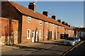
Bluegate
Early 19th century houses on Bluegate
Image: © Richard Croft
Taken: 13 Feb 2014
0.02 miles
6
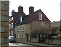
31-32 Castlegate, Grantham
Pair of late 18th century stone-built cottages, Listed Grade II.
Image: © Alan Murray-Rust
Taken: 15 Feb 2017
0.02 miles
7
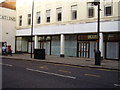
It's not just the little guys that close down
Marks and Spencer's in Grantham high Street stands empty as event the big players make cut backs.
Image: © Anthony Vosper
Taken: 24 Feb 2011
0.02 miles
8
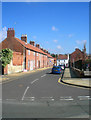
Bluegate, Grantham
Bluegate is a pleasant little street of red-brick cottages, just south of St Wulfram's. This shot was taken from near the Blue Pig, in Swinegate, while the street to be seen at the far end of Bluegate is Castlegate. Lincolnshire was once part of the old Danelaw, so place names - including street names - reflect Danish influence. 'Gate' in these street names derives from a Scandinavian word meaning 'street', and doesn't imply there was ever a 'gate' here, in the sense in which we now understand it.
Image: © Stefan Czapski
Taken: 31 Mar 2008
0.03 miles
9
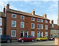
28-30 Castlegate, Grantham
A group of three late 18th century houses, Listed Grade II.
Image: © Alan Murray-Rust
Taken: 15 Feb 2017
0.03 miles
10
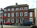
25-26 Castlegate, Grantham
A pair of late 18th century houses, 3-bay, s-storey, Listed Grade II.
Image: © Alan Murray-Rust
Taken: 15 Feb 2017
0.03 miles