
IMAGES TAKEN NEAR TO
Caravan Site, Bassingfield Lane, NOTTINGHAM, NG2 6NL
Introduction
This page details the photographs taken nearby to Caravan Site, Bassingfield Lane, NG2 6NL by members of the Geograph project.
The Geograph project started in 2005 with the aim of publishing, organising and preserving representative images for every square kilometre of Great Britain, Ireland and the Isle of Man.

There are currently over 7.5m images from over14,400 individuals and you can help contribute to the project by visiting https://www.geograph.org.uk
Image Map
Images are licensed for reuse under creativecommons.org/licenses/by-sa/2.0
Notes
- Clicking on the map will re-center to the selected point.
- The higher the marker number, the further away the image location is from the centre of the postcode.
Image Listing (34 Images Found)
Images are licensed for reuse under creativecommons.org/licenses/by-sa/2.0
Image
Details
Distance
1
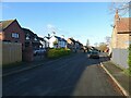
Old Tollerton Road
The heart of the small village of Gamston before the late 20th century housing estate was developed.
Image: © Alan Murray-Rust
Taken: 10 Dec 2021
0.07 miles
2
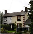
Houses on Main Street, Gamston
There are a handful of old houses along main street, which must be the heart of old Gamston village, now submerged under a flood of new housing.
Image: © Oxymoron
Taken: 28 Aug 2008
0.09 miles
3
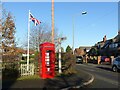
Telephone kiosk and fingerpost
As with many such kiosks, it has been taken over by the parish council, in this instance as an information centre. The fingerpost is a traditional Nottinghamshire County Council style.
Image: © Alan Murray-Rust
Taken: 10 Dec 2021
0.09 miles
4
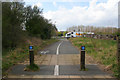
Cycleway near Bassingfield
This cycleway follows the old line of Bassingfield Lane. The road was diverted when the A52 Gamston Lings Bar Road was built to bypass West Bridgford and the southern suburbs of Nottingham. There is a traffic light controlled crossing across the dual carriageway.
Image: © Kate Jewell
Taken: 31 Mar 2008
0.10 miles
5
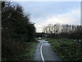
Cycle path at Gamston
Follows the original route of Bassingfield Lane before the construction of Toll Bar Road.
Image: © Jonathan Thacker
Taken: 21 Dec 2018
0.10 miles
6
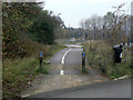
Bassingfield Lane
The vegetation continues to encroach on the surface - compare with 2005 http://www.geograph.org.uk/photo/51948 and 2008 http://www.geograph.org.uk/photo/746360
Image: © Alan Murray-Rust
Taken: 13 Nov 2011
0.10 miles
7
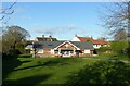
Gamston Village Hall
Timber building set in an attractive green.
Image: © Alan Murray-Rust
Taken: 10 Dec 2021
0.11 miles
8
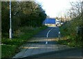
Gamston Cycleway
Recreating this 'First' for the square http://www.geograph.org.uk/photo/51948
This links Gamston and Nottingham with the Grantham Canal towpath. Here it follows the original line of Bassingfield Lane prior to the construction of the Lings Bar section of the A52.
Image: © Alan Murray-Rust
Taken: 10 Dec 2021
0.11 miles
9
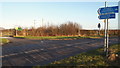
Bassingfield Lane, Gamston, Nottingham 2
The yellow sign ahead is at the gated entrance to the "Bassingfield Waste Transfer Station". This is currently no more than a fenced-in tarmac-covered area the size of two tennis courts that may occasionally be used for skips? A paved footpath and cycle route to the left of the yellow sign carries users over the busy A52 Nottingham/Grantham Road (the Gamston Lings Bar dual carriageway). An identity plaque on the right announces the commencement and termination of the village of Bassingfield. If Bassingfield Lane is followed - to the left - it joins Tollerton Road within a matter of minutes.
Image: © David Hallam-Jones
Taken: 29 Dec 2013
0.12 miles
10
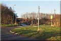
Bassingfield Lane, Gamston, Nottingham 2
The cycle route ahead links Bassingfield Lane and Gamston. Pedestrian or cyclist-controlled traffic lights in the distance allows users to cross the Gamston Lings Bar Road (i.e. the A52) more safely than might otherwise be the case. The yellow sign on the right is at the gated entrance to the "Bassingfield Waste Transfer Station". This is currently no more than a fenced-in tarmac-covered area the size of two tennis courts that may occasionally be used for skips?
Image: © David Hallam-Jones
Taken: 29 Dec 2013
0.12 miles