Bassingfield Lane, Gamston, Nottingham 2
Introduction
The photograph on this page of Bassingfield Lane, Gamston, Nottingham 2 by David Hallam-Jones as part of the Geograph project.
The Geograph project started in 2005 with the aim of publishing, organising and preserving representative images for every square kilometre of Great Britain, Ireland and the Isle of Man.

There are currently over 7.5m images from over 14,400 individuals and you can help contribute to the project by visiting https://www.geograph.org.uk
Bassingfield Lane, Gamston, Nottingham 2
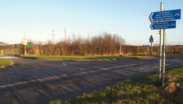
Image: © David Hallam-Jones Taken: 29 Dec 2013
The yellow sign ahead is at the gated entrance to the "Bassingfield Waste Transfer Station". This is currently no more than a fenced-in tarmac-covered area the size of two tennis courts that may occasionally be used for skips? A paved footpath and cycle route to the left of the yellow sign carries users over the busy A52 Nottingham/Grantham Road (the Gamston Lings Bar dual carriageway). An identity plaque on the right announces the commencement and termination of the village of Bassingfield. If Bassingfield Lane is followed - to the left - it joins Tollerton Road within a matter of minutes.
Images are licensed for reuse under creativecommons.org/licenses/by-sa/2.0
Image Location
Latitude
52.927794
Longitude
-1.098191