1
Bridgford Lock, Grantham Canal
Lock number 2 on this disused canal. It is believed that the lock gates here were removed in the 1950s. Luckily someone had the foresight to build a weir at this time to maintain the water level otherwise this stretch of the canal would be dry.
Image: © Kate Jewell
Taken: 10 Apr 2010
0.05 miles
2
Information board along the Grantham Canal
Next to the derelict Gamston Lock No 2 at Gamston.
Image: © Mat Fascione
Taken: 12 Nov 2017
0.05 miles
3
Gamston Lock, #2 on the Grantham Canal
The canal runs for 33 miles between Grantham and the River Trent at West Bridgford. The canal, which opened in 1797 and was abandoned in 1936, is now mostly derelict. The canal had 18 locks, most of which have been demolished. Since the 1970s, the Grantham Canal Society have been working towards restoring the canal, and two stretches are now navigable.
Image: © Graham Hogg
Taken: 11 Oct 2016
0.05 miles
4
Bridgford Lock No.2
The lower of the pair of locks as the Grantham Canal passes through the Gamston development.
Image: © Alan Murray-Rust
Taken: 13 Dec 2009
0.06 miles
5
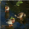
Three Mallard
Standing on the upper cill of the remains of Bridgford Lock https://www.geograph.org.uk/photo/1623154 on the Grantham Canal
Image: © Alan Murray-Rust
Taken: 10 Dec 2021
0.06 miles
6
Bridgford Lock
Lock number 2 on the disused Grantham Canal
Image: © Richard Croft
Taken: 3 Sep 2012
0.06 miles
7
Grantham Canal at Gamston
Forming the boundary between West Bridgford (on the left) and Gamston (on the right), this disused canal has become an important recreational resource even though it is no longer navigable.
Image: © Kate Jewell
Taken: 10 Apr 2010
0.07 miles
8
Grantham Canal information board
This informative board has been sited by the new footbridge over the Bridgford lock. The bridge allows direct access from the new Gamston residential housing to the towpath along the canal which is developing into a valuable recreational resource along its 33 miles between the River Trent, Nottingham and Grantham.
See http://www.granthamcanal.org/ for more information.
Image: © Kate Jewell
Taken: 10 Apr 2010
0.07 miles
9
Bridgford Lock
Lock number 2 on the disused Grantham Canal
Image: © Richard Croft
Taken: 3 Sep 2012
0.07 miles
10
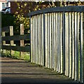
Light and shade
Railings at a footbridge over the Grantham Canal, Gamston.
Image: © Alan Murray-Rust
Taken: 10 Dec 2021
0.07 miles


