
IMAGES TAKEN NEAR TO
Rutland Road, NOTTINGHAM, NG2 5DY
Introduction
This page details the photographs taken nearby to Rutland Road, NG2 5DY by members of the Geograph project.
The Geograph project started in 2005 with the aim of publishing, organising and preserving representative images for every square kilometre of Great Britain, Ireland and the Isle of Man.

There are currently over 7.5m images from over14,400 individuals and you can help contribute to the project by visiting https://www.geograph.org.uk
Image Map
Images are licensed for reuse under creativecommons.org/licenses/by-sa/2.0
Notes
- Clicking on the map will re-center to the selected point.
- The higher the marker number, the further away the image location is from the centre of the postcode.
Image Listing (65 Images Found)
Images are licensed for reuse under creativecommons.org/licenses/by-sa/2.0
Image
Details
Distance
1
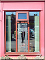
The Poppy and Pint, Lady Bay
Detail of this pink pub, a former British Legion club, with reflections of the car park in the window. See also Image
Image: © Stephen McKay
Taken: 18 Apr 2015
0.03 miles
2
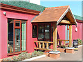
The Poppy and Pint, Lady Bay
Despite the garish colour scheme, this former British Legion club is a pleasant, if unusual, pub. Completely embedded in the suburban Lady Bay area of West Bridgford, it would be easy to miss but is accessed from Pierrepont Road. To the rear of the building is a bowling green.
Image: © Stephen McKay
Taken: 18 Apr 2015
0.03 miles
3
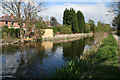
The Grantham Canal
This canal once linked the River Trent to Grantham, a distance of 33 miles. It was closed in 1936. Most of the waterway still contains water and is used both as a wildlife refuge and as a recreational resource for walkers, cyclists and horse riders. There is a flourishing restoration society http://www.granthamcanal.com/ which is aiming to open the canal to boats once again. This stretch is bounded by the busy A52 and West Bridgford to the right and housing in Lady Bay on the left. These houses are on Ropsley Crescent.
Image: © Kate Jewell
Taken: 1 May 2008
0.04 miles
4
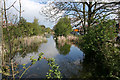
The Grantham Canal
Through West Bridgford the canal runs alongside the A52 until it turns east at Gamston towards Cotgrave and the Vale of Belvoir. See http://www.granthamcanal.com/ for more information.
Image: © Kate Jewell
Taken: 1 May 2008
0.05 miles
5
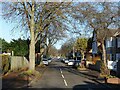
Gertrude Road, Lady Bay, West Bridgford
The Lady Bay area with its grid-based layout was developed from the late 19th century, mainly with typical semi-detached villas. This end of the road was not developed until the first half of the 20th century.
Image: © Alan Murray-Rust
Taken: 10 Dec 2021
0.06 miles
6
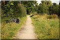
Grantham Canal towpath
Towpath by the disused Grantham Canal
Image: © Richard Croft
Taken: 3 Sep 2012
0.06 miles
7
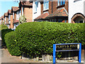
Pierrepont Road, Lady Bay
Suburban semis line the east side of Pierrepont Road in the Lady Bay area of West Bridgford. The origin of the Lady Bay name is obscure, one suggestion being that it refers to a bay mare that was once kept in fields here. The sign marking the way to the Poppy and Pint pub is also unusual - as is the pub itself (seeImage).
Image: © Stephen McKay
Taken: 18 Apr 2015
0.06 miles
8
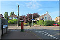
West Bridgford: Gertrude Road and Rutland Road
Looking towards the path to Radcliffe Road on a warm July morning. The pillar box has been yarn-bombed.
Image: © John Sutton
Taken: 27 Jul 2022
0.06 miles
9
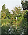
The Grantham Canal near Gertrude Road
The canal was abandoned in 1936. This section forms a pleasant walk and wildlife corridor beside Radcliffe Road.
Image: © John Sutton
Taken: 8 Sep 2016
0.07 miles
10
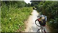
Bike on the canal towpath
The Grantham Canal in West Bridgford
Image: © David Lally
Taken: 13 Jul 2018
0.07 miles