
IMAGES TAKEN NEAR TO
Greenacres Park, Adbolton Lane, NOTTINGHAM, NG2 5AX
Introduction
This page details the photographs taken nearby to Greenacres Park, Adbolton Lane, NG2 5AX by members of the Geograph project.
The Geograph project started in 2005 with the aim of publishing, organising and preserving representative images for every square kilometre of Great Britain, Ireland and the Isle of Man.

There are currently over 7.5m images from over14,400 individuals and you can help contribute to the project by visiting https://www.geograph.org.uk
Image Map
Images are licensed for reuse under creativecommons.org/licenses/by-sa/2.0
Notes
- Clicking on the map will re-center to the selected point.
- The higher the marker number, the further away the image location is from the centre of the postcode.
Image Listing (24 Images Found)
Images are licensed for reuse under creativecommons.org/licenses/by-sa/2.0
Image
Details
Distance
1
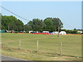
Overspill area
Part of the large caravan and camping site attached to the National Water Sports Centre
Image: © Alan Murray-Rust
Taken: 2 Jul 2009
0.10 miles
2
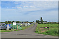
Adbolton: the entrance to Greenacres Park
Camp site on the left, mobile home park ahead.
Image: © John Sutton
Taken: 28 May 2017
0.13 miles
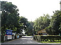
4
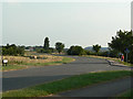
Regatta Way
This was a new road built for access direct from the A52 to the National Water Sports Centre. At this point it joins the old-established Adbolton Lane.
Image: © Alan Murray-Rust
Taken: 2 Jul 2009
0.18 miles
5
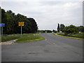
Junction of Adbolton Lane and Adbolton Lane
At this point, a little way east of Lady Bay, Adbolton Lane (left) joins...Adbolton Lane. At this point, the main road from Holme Pierrepont and the National Water Sports Centre curves south (centre to right), changing from Adbolton Lane into Regatta Way as it does so. Before the construction of Regatta Way, which provides quick access to the A52 near Gamston Bridge, Adbolton Lane would have continued west in a roughly straight line; the very verdant verge on the left is now on that alignment. Lady Bay Home Zone, mentioned on the yellow sign, is the residential part of Lady Bay, the "Home Zone" designation indicating that it has many traffic calming measures.
Image: © Richard Vince
Taken: 10 Jun 2013
0.18 miles
6
Adbolton Lane
A field of horses off Adbolton Lane.
Image: © Gerald England
Taken: 20 Sep 2003
0.18 miles
8
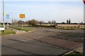
Junction on Adbolton Lane
The lane turns left here to the Holme Pierripont water-sports centre. The road coming in from the right is Regatta Way, built to give access to the centre directly from Radcliffe Road, avoiding the use of Trent Boulevard through Lady Bay.
Image: © David Lally
Taken: 21 Jan 2010
0.18 miles
9
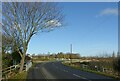
Regatta Way, West Bridgford
Looking towards the junction with Adbolton Lane.
Image: © Alan Murray-Rust
Taken: 10 Dec 2021
0.19 miles
10

Regatta Way
Built to give access to the Holme Perrepont water-sports centre directly from Radcliffe Road, avoiding the use of Trent Boulevard through Lady Bay.
Image: © David Lally
Taken: 21 Jan 2010
0.19 miles