IMAGES TAKEN NEAR TO
Northgate Retail Park, NEWARK, NG24 1GA
Introduction
This page details the photographs taken nearby to Northgate Retail Park, NG24 1GA by members of the Geograph project.
The Geograph project started in 2005 with the aim of publishing, organising and preserving representative images for every square kilometre of Great Britain, Ireland and the Isle of Man.

There are currently over 7.5m images from over14,400 individuals and you can help contribute to the project by visiting https://www.geograph.org.uk
Image Map
Images are licensed for reuse under creativecommons.org/licenses/by-sa/2.0
Notes
- Clicking on the map will re-center to the selected point.
- The higher the marker number, the further away the image location is from the centre of the postcode.
Image Listing (227 Images Found)
Images are licensed for reuse under creativecommons.org/licenses/by-sa/2.0
Image
Details
Distance
1
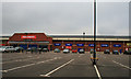
Newark Woolworths
The largest Woolies I've seen, but closed like the rest of them!
Image: © David Lally
Taken: 29 Jan 2009
0.05 miles
2
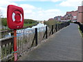
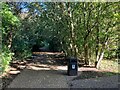
Path along the River Trent in Newark-on-Trent
Image: © Mat Fascione
Taken: 19 Apr 2016
0.05 miles
3
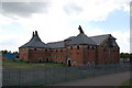
Northgate Maltings, Newark
Grade II Listed. The Cowls are in working order, with star-shaped vanes. The building was up for sale at the time of the picture.
Image: © Julian P Guffogg
Taken: 24 May 2011
0.06 miles
4
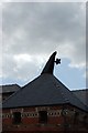
Detail of Cowl, North Gate maltings
Image: © Julian P Guffogg
Taken: 24 May 2011
0.06 miles
5
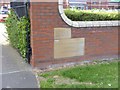
Warwick's and Richardson's, 1938
Two stones from the former brewery buildings have been incorporated into the boundary wall of the modern retail development as a marginal reminder of the large brewing concern formerly occupying the site.
Image: © Alan Murray-Rust
Taken: 4 Sep 2012
0.06 miles
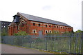
7
The former Warwick and Richardson's Brewery
Work began in 1882 to the design of William Bliss Sanders.
Image: © Jonathan Thacker
Taken: 3 Jan 2011
0.07 miles
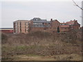
9
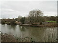
Bridge abutment
A bridge here crossed the River Trent carrying a railway which linked the Midland and Great Northern systems in Newark. This fell into disuse in the early 1970s and was subsequently demolished.
The track at the side is a temporary roadway providing access to Newark Weir where a hydro-electric power scheme is being constructed.
Image: © Jonathan Thacker
Taken: 23 Feb 2021
0.07 miles