Warwick's and Richardson's, 1938
Introduction
The photograph on this page of Warwick's and Richardson's, 1938 by Alan Murray-Rust as part of the Geograph project.
The Geograph project started in 2005 with the aim of publishing, organising and preserving representative images for every square kilometre of Great Britain, Ireland and the Isle of Man.

There are currently over 7.5m images from over 14,400 individuals and you can help contribute to the project by visiting https://www.geograph.org.uk
Warwick's and Richardson's, 1938
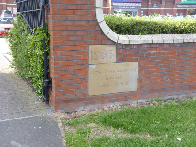
Image: © Alan Murray-Rust Taken: 4 Sep 2012
Two stones from the former brewery buildings have been incorporated into the boundary wall of the modern retail development as a marginal reminder of the large brewing concern formerly occupying the site.
Images are licensed for reuse under creativecommons.org/licenses/by-sa/2.0
Image Location
Latitude
53.082935
Longitude
-0.803495