
IMAGES TAKEN NEAR TO
Arkwright Walk, NOTTINGHAM, NG2 2HW
Introduction
This page details the photographs taken nearby to Arkwright Walk, NG2 2HW by members of the Geograph project.
The Geograph project started in 2005 with the aim of publishing, organising and preserving representative images for every square kilometre of Great Britain, Ireland and the Isle of Man.

There are currently over 7.5m images from over14,400 individuals and you can help contribute to the project by visiting https://www.geograph.org.uk
Image Map
Images are licensed for reuse under creativecommons.org/licenses/by-sa/2.0
Notes
- Clicking on the map will re-center to the selected point.
- The higher the marker number, the further away the image location is from the centre of the postcode.
Image Listing (293 Images Found)
Images are licensed for reuse under creativecommons.org/licenses/by-sa/2.0
Image
Details
Distance
1
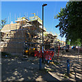
Arkwright walk: building new houses
Many of the Victorian houses in The Meadows were demolished in the 1970s. Now the replacement council houses are being replaced.
Image: © John Sutton
Taken: 26 Jun 2018
0.01 miles
2
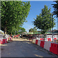
Redevelopment in The Meadows
New houses on Arkwright Walk (once Arkwright Street, the main bus route into the city from the south). Many of the Victorian residential and shopping streets in The Meadows were demolished in the 1970s. Now the replacement council houses are being replaced.
Image: © John Sutton
Taken: 26 Jun 2018
0.01 miles
3
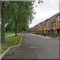
New houses on Arkwright Walk
Much of the Victorian Meadows district was demolished in the 1970s, new houses built and the street pattern altered. The pedestrianised Arkwright Walk was once one of two main routes south from the city centre to Trent Bridge, lined with shops and busy with cars, lorries, buses and trolleybuses. Now some of the 1970s houses are being replaced.
These pictures - taken elsewhere on Arkwright Walk - give an idea of the houses which are being replaced:
Image]
Image]
Image] (Stephen McKay)
Image: © John Sutton
Taken: 1 Jul 2019
0.02 miles
4
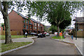
Arkwright Walk changing
Much of the Victorian Meadows district was demolished in the 1970s, new houses built and the street pattern altered. The pedestrianised Arkwright Walk was once one of two main routes south from the city centre to Trent Bridge, lined with shops and busy with cars, lorries, buses and trolleybuses. Now some of the 1970s houses are being replaced.
These pictures - taken elsewhere on Arkwright Walk - give an idea of the houses which are being replaced:
Image]
Image]
Image] (Stephen McKay)
Image: © John Sutton
Taken: 1 Jul 2019
0.02 miles
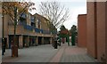
6
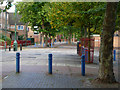
Arkwright Walk, The Meadows
Once a busy thoroughfare, what used to be Arkwright Street is now a quiet walkway through a 1970s housing estate. Nottingham City Council has plans to regenerate the area which suffers from the usual range of inner-city social problems.
Image: © Stephen McKay
Taken: 25 Sep 2007
0.02 miles
7
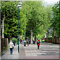
Up Arkwright Walk
Pedestrianised since the Meadows was rebuilt in the 1970s, this was once Arkwright Street, the main route from the city centre to Trent Bridge and a busy bus and trolleybus route.
Image: © John Sutton
Taken: 19 May 2015
0.03 miles
8
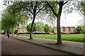
Arkwright Walk and Lammas Gardens
A view across the green space and playground at the city end of what was originally Arkwright Street, one of the city's main bus and trolleybus routes. In the background are the backs of houses on Lammas Gardens.
Image: © John Sutton
Taken: 19 May 2015
0.04 miles
9
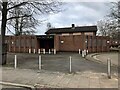
The Riverway
There appears to be no pictures of this pub when it was open.
Image: © David Lally
Taken: 3 Mar 2023
0.05 miles
10
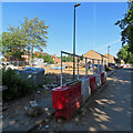
Building site on Arkwright Walk
Building new houses on Arkwright Walk (once Arkwright Street, the main bus route into the city from the south). Many of the Victorian residential and shopping streets in The Meadows were demolished in the 1970s. Now the replacement council houses are being replaced.
Image] gives an idea of the south end of Arkwright Walk in 2013.
Image: © John Sutton
Taken: 26 Jun 2018
0.05 miles