
IMAGES TAKEN NEAR TO
Halifax Place, NEWARK, NG22 8FG
Introduction
This page details the photographs taken nearby to Halifax Place, NG22 8FG by members of the Geograph project.
The Geograph project started in 2005 with the aim of publishing, organising and preserving representative images for every square kilometre of Great Britain, Ireland and the Isle of Man.

There are currently over 7.5m images from over14,400 individuals and you can help contribute to the project by visiting https://www.geograph.org.uk
Image Map
Images are licensed for reuse under creativecommons.org/licenses/by-sa/2.0
Notes
- Clicking on the map will re-center to the selected point.
- The higher the marker number, the further away the image location is from the centre of the postcode.
Image Listing (27 Images Found)
Images are licensed for reuse under creativecommons.org/licenses/by-sa/2.0
Image
Details
Distance
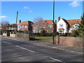
2
Brickyard Lane, Farnsfield, Notts.
Nether Court (a cul-de-sac) is a side road serving a small housing development. It is seen here at its junction with Brickyard Lane. Main Street, the principal road through the centre of the village, is 5-6 minutes walk away behind the photographer. Ahead is an access point onto the Southwell Trail no more than 10 minutes walk away.
Image: © David Hallam-Jones
Taken: 20 Dec 2014
0.12 miles
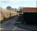
3
Brickyard Lane, Farnsfield, Notts.
An untamed ash hedge at the side of Brickyard Lane, near to its junction with Nether Court. Access to the village is behind the photographer and one of several access points onto the Southwell Trail is situated 10 minutes or so walk ahead. The field on the left is currently being used for horse grazing.
Image: © David Hallam-Jones
Taken: 20 Dec 2014
0.13 miles
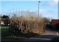
4
Brickyard Lane
Looking east along a quiet cul-de-sac of tidy bungalows.
Image: © Trevor Rickard
Taken: 8 May 2010
0.17 miles
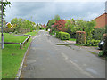
5
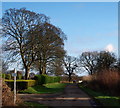
Brickyard Lane, Farnsfield, Notts.
A post bearing a "No unauthorised motor vehicles" sign and a "public footpath" sign marks the entrance to Severn Trent's Farnsfield Water Pumping Station (Operational since 1893). 10 minutes walk ahead is an access point onto the Southwell Trail, whilst the village itself lies a 10 minute walk away behind the photographer.
Image: © David Hallam-Jones
Taken: 20 Dec 2014
0.17 miles
6
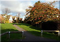
Off Brickyard Lane, Farnsfield, Notts.
An footpath entrance/exit point. The path serves to connect this properties in this part of the village and it crosses Milldale Road - ahead - within a matter of minutes. The properties seen here are the rear elevations of houses lining The Ridgeway.
Image: © David Hallam-Jones
Taken: 20 Dec 2014
0.18 miles
7
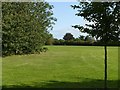
Parfitt Drive Field, Farnsfield
A well maintained public area.
Image: © Alan Murray-Rust
Taken: 20 Sep 2020
0.18 miles
8
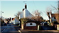
Island Cottage, Farnsfield, Notts.
The Ridgeway (< a road name) can be reached via Southwell Road on the left or via the passageway on the right. This is a view looking towards Main Street that commences near The Plough public house ahead.
Image: © David Hallam-Jones
Taken: 30 Jan 2015
0.18 miles
9
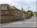
Grange Farm Main Street
Barn walls and gateway in coursed rubble stonework. There is a bench mark http://www.geograph.org.uk/photo/4015800 on the near corner of the barn.
Image: © Alan Murray-Rust
Taken: 1 Jun 2014
0.18 miles
10
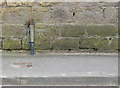
Bench mark, Grange Farm
See http://www.geograph.org.uk/photo/4015795 for location.
Image: © Alan Murray-Rust
Taken: 1 Jun 2014
0.18 miles