
IMAGES TAKEN NEAR TO
Risley Drive, NOTTINGHAM, NG2 1QL
Introduction
This page details the photographs taken nearby to Risley Drive, NG2 1QL by members of the Geograph project.
The Geograph project started in 2005 with the aim of publishing, organising and preserving representative images for every square kilometre of Great Britain, Ireland and the Isle of Man.

There are currently over 7.5m images from over14,400 individuals and you can help contribute to the project by visiting https://www.geograph.org.uk
Image Map
Images are licensed for reuse under creativecommons.org/licenses/by-sa/2.0
Notes
- Clicking on the map will re-center to the selected point.
- The higher the marker number, the further away the image location is from the centre of the postcode.
Image Listing (224 Images Found)
Images are licensed for reuse under creativecommons.org/licenses/by-sa/2.0
Image
Details
Distance
1
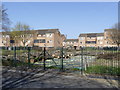
Off Risley Drive
I don't have a map which actually shows what used to be on this site, but it may have been some sort of community facility. It is current being used to store the felled trees from the new tramway construction areas. There have been earmarked as raw materials for community projects including tree sculptures.
Image: © Alan Murray-Rust
Taken: 1 Apr 2012
0.02 miles
2
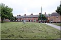
Hawthorn View, The Meadows
One of the few groups of houses which survived the demolition and replanning of the area in the 1970s. Dating from probably the 1930s, they were much more modern than the 19th century terraces which formed the bulk of the area.
Image: © Alan Murray-Rust
Taken: 21 Jun 2012
0.03 miles
3
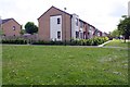
Housing near Tarbert Close
Ordnance Survey documents indicate that in 1981 a benchmark levelled at 25.49m above Newlyn Datum was verified on the entrance to No. 14 Tarbert Close
Image: © Luke Shaw
Taken: 11 May 2019
0.04 miles
4
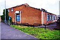
Former Spinning Jenny pub on east side of Meadows Way
There is an Ordnance Survey benchmark Image on the near corner, right hand face, of the building
Image: © Luke Shaw
Taken: 11 May 2019
0.06 miles
5
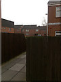
Saffron Gardens
Typical of the 1960s development of the Meadows area of Nottingham.
Image: © David Lally
Taken: 6 Apr 2009
0.07 miles
6
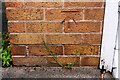
Benchmark on former pub on east side of Meadows Way
Ordnance Survey cut mark benchmark described on the Bench Mark Database at www.bench-marks.org.uk/bm114990
Image: © Luke Shaw
Taken: 11 May 2019
0.07 miles
7
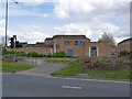
Meadows Police Station, Nottingham
Removal of trees for the tram extension has opened up this view.
Image: © Alan Murray-Rust
Taken: 23 Apr 2012
0.07 miles
8
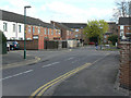
Beardsley Gardens
Typical cul-de-sac in the Meadows. This provides rear access for motor traffic, with main frontages facing onto a series of pedestrian ways linking to the main local facilities. Main distributor roads run round the periphery of the housing. This is generally known as Radburn layout, based on the original development in this style in Radburn, New Jersey (USA). See Wikipedia http://en.wikipedia.org/wiki/Radburn,_New_Jersey .
Image: © Alan Murray-Rust
Taken: 7 Apr 2009
0.07 miles
9
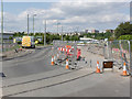
Tramway, Meadows Way West
Both tracks are now largely complete where the route curves to cross onto Enterprise Way.
Image: © Alan Murray-Rust
Taken: 21 Jul 2014
0.08 miles
10
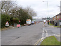
Meadows Way West - 1
Service work and closures have moved further westwards along this road.
Image: © Alan Murray-Rust
Taken: 21 Mar 2013
0.08 miles