1
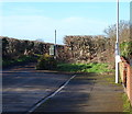
Stonebridge Lane, Market Warsop
Image: © Neil Theasby
Taken: 4 Nov 2021
0.05 miles
2
Stonebridge Lane, Market Warsop, Notts.
Houses on Stonebridge Lane seen from Sookholme Lane.
Image: © David Hallam-Jones
Taken: 28 Jan 2016
0.17 miles
3
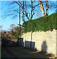
Sookholme Lane, Market Warsop
The western edge of the town pictured from the western edge of the grid square. At the point where the byway becomes a metalled road.
Image: © Jonathan Clitheroe
Taken: 19 Apr 2022
0.18 miles
4
Sookholme Lane, Market Warsop, Notts.
This is the front (boundary) wall belonging to the final (or first) house on the residentially-developed section of Sookholme Lane. The remainder of it, approximately two miles in length, is a track passing through agricultural land. A third of the way along its length from this end, a stone bridge carries users across the River Meden
Image: © David Hallam-Jones
Taken: 28 Jan 2016
0.18 miles
5
The end of Argyle Close
Modern housing development on the west of Market Warsop seen across the River Meden.
Image: © Alan Murray-Rust
Taken: 27 Mar 2011
0.18 miles
6
Old Sookholme Lane, Market Warsop, Notts.
This is the easterly-most section of what was formerly a rural lane, one that emptied out into the A60 (Market Warsop-Mansfield road). When houses were first built behind the adjacent Gate Inn, the construction a new residential road - Vale Avenue - bisected Old Sookholme Lane, creating this 200 metre long stub. This seems to have become a dumping ground for building debris and rubbish.
Image: © David Hallam-Jones
Taken: 28 Jan 2016
0.18 miles
7
Sookholme Lane, Market Warsop, Notts.
The eastern end of Sookholme Lane. This is the point at which the lane changes from being a rural lane passing through agricultural land to a residential road. The hamlet of Sookholme lies 2-2.5 miles behind the photographer and the A60 (the main Market Warsop - Mansfield road) 1/2 mile ahead.
Image: © David Hallam-Jones
Taken: 28 Jan 2016
0.19 miles
8
The Gate Inn, Warsop (for sale)
Image: © Stephen Ostler
Taken: 4 Jan 2020
0.21 miles
9
The Gate
A public house and restaurant. The menu offers a 72oz steak though the barman said he had never known anyone order one.
Image: © Graham Hogg
Taken: 31 May 2016
0.21 miles
10
Medical centre, Warsop
Image: © JThomas
Taken: 16 Mar 2014
0.21 miles


