IMAGES TAKEN NEAR TO
Knowle Park, NOTTINGHAM, NG16 2PY
Introduction
This page details the photographs taken nearby to Knowle Park, NG16 2PY by members of the Geograph project.
The Geograph project started in 2005 with the aim of publishing, organising and preserving representative images for every square kilometre of Great Britain, Ireland and the Isle of Man.

There are currently over 7.5m images from over14,400 individuals and you can help contribute to the project by visiting https://www.geograph.org.uk
Image Map
Images are licensed for reuse under creativecommons.org/licenses/by-sa/2.0
Notes
- Clicking on the map will re-center to the selected point.
- The higher the marker number, the further away the image location is from the centre of the postcode.
Image Listing (47 Images Found)
Images are licensed for reuse under creativecommons.org/licenses/by-sa/2.0
Image
Details
Distance
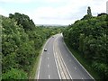
2
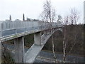
Footbridge from Knowle Hill, Kimberley
Crossing the A610 dual-carriageway. When I used the bridge in 2001 I was following the Robin Hood Way (according to my 1985 guide), but this has now been diverted further west.
Image: © Tim Heaton
Taken: 29 Dec 2008
0.08 miles
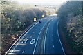
3
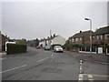
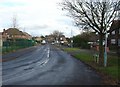
Knowle Lane, Swingate
Looking north from its junction with Park Avenue, showing two contrasting styles (and ages) of housing. Knowle Lane was severed as a through road to Nottingham Road by the Kimberley and Eastwood bypass (part of the A610), but a pedestrian bridge still links the two sections of the road.
Image: © Richard Vince
Taken: 25 Sep 2013
0.08 miles
4
South end of Clive Crescent, Swingate
Seen from Knowle Lane.
Image: © Richard Vince
Taken: 25 Sep 2013
0.09 miles
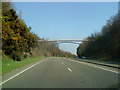
7
The A610
From the Knowle Hill footbridge. looking east.
Image: © David Lally
Taken: 1 Dec 2020
0.10 miles
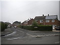
9
Knowle Lane, Swingate
This is part of the more modern development of Swingate.
Image: © Alan Murray-Rust
Taken: 11 Nov 2007
0.14 miles
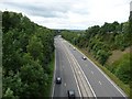
10
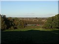
Field near Swingate
The field terminates below the embankment beside the A610, which here forms the Nuthall-Kimberley-Eastwood bypass. Beyond the road is part of Nuthall, and in the distance the hills of north Nottinghamshire.
Image: © Lynne Kirton
Taken: 13 Nov 2010
0.15 miles