IMAGES TAKEN NEAR TO
Papplewick, NOTTINGHAM, NG15 8FA

Introduction

This page details the photographs taken nearby to NG15 8FA by members of the Geograph project.

The Geograph project started in 2005 with the aim of publishing, organising and preserving representative images for every square kilometre of Great Britain, Ireland and the Isle of Man.

There are currently over 7.5m images from over14,400 individuals and you can help contribute to the project by visiting https://www.geograph.org.uk

Image Map


Images are licensed for reuse under creativecommons.org/licenses/by-sa/2.0
Notes
  • Clicking on the map will re-center to the selected point.
  • The higher the marker number, the further away the image location is from the centre of the postcode.

Image Listing (30 Images Found)

Images are licensed for reuse under creativecommons.org/licenses/by-sa/2.0
  • ...
Image
Details
Distance
1
Blocked culvert
At the southern end of the Papplewick Trail, this excavated culvert entrance presumably would have carried the mill races under Moor Road?
Image: © David Lally Taken: 27 Oct 2021
0.03 miles
2
Papplewick village sign
On Moor Road, this version refers to the ponds along the River Leen. Papplewick has chosen to have more than one design of the new sign.
Image: © Alan Murray-Rust Taken: 1 Jun 2014
0.03 miles
3
Footpath south of Papplewick
Image: © JThomas Taken: 16 Apr 2010
0.05 miles
4
Nottingham, NG15 - Papplewick
George Robinson owned a number of cotton mills in this area during the late 18th century and sufficient water power had to be produced from the weak-flowing River Leen at many places along its course using a system of leats. This is a picture of some conservation work that is currently being undertaken in a wooded area off Moor Lane (the B683), near its junction with Linby Lane (the B6011) where a sluice seems to have been built to control the flow of water to a lower level.
Image: © David Hallam-Jones Taken: 2 Dec 2012
0.05 miles
5
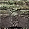
An interesting keystone
In the arch of Image Possibly a Green Man representation?
Image: © David Lally Taken: 27 Oct 2021
0.05 miles
6
B683 towards Papplewick
Image: © JThomas Taken: 16 Apr 2010
0.05 miles
7
Papplewick Trail
The trail is based on the water-driven industries along the Leen Valley. This short length of path through a spring meadow cuts the corner of Moor Lane and Papplewick Lane.
Image: © Alan Murray-Rust Taken: 1 Jun 2014
0.06 miles
8
Mini roundabout at the top of Papplewick Lane
The village of Papplewick is another half a kilometre along the road ahead.
Image: © Bill Boaden Taken: 15 Oct 2022
0.07 miles
9
Path onto Papplewick Moor
Part of the Robin Hood Way heading towards Burntstump Hill.
Image: © Bill Boaden Taken: 15 Oct 2022
0.08 miles
10
Papplewick Moor Lane postbox ref NG15 31
Standard EIIR lampbox, fixed to a traditional wooden pole.
Image: © Alan Murray-Rust Taken: 1 Jun 2014
0.09 miles
  • ...