Nottingham, NG15 - Papplewick
Introduction
The photograph on this page of Nottingham, NG15 - Papplewick by David Hallam-Jones as part of the Geograph project.
The Geograph project started in 2005 with the aim of publishing, organising and preserving representative images for every square kilometre of Great Britain, Ireland and the Isle of Man.

There are currently over 7.5m images from over 14,400 individuals and you can help contribute to the project by visiting https://www.geograph.org.uk
Nottingham, NG15 - Papplewick
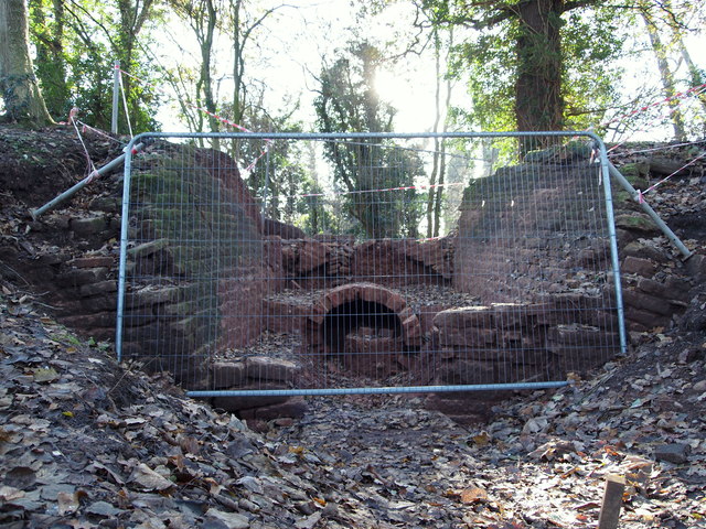
Image: © David Hallam-Jones Taken: 2 Dec 2012
George Robinson owned a number of cotton mills in this area during the late 18th century and sufficient water power had to be produced from the weak-flowing River Leen at many places along its course using a system of leats. This is a picture of some conservation work that is currently being undertaken in a wooded area off Moor Lane (the B683), near its junction with Linby Lane (the B6011) where a sluice seems to have been built to control the flow of water to a lower level.
Images are licensed for reuse under creativecommons.org/licenses/by-sa/2.0
Image Location
Latitude
53.048233
Longitude
-1.182499