
IMAGES TAKEN NEAR TO
Cliff Road, NOTTINGHAM, NG1 1GT
Introduction
This page details the photographs taken nearby to Cliff Road, NG1 1GT by members of the Geograph project.
The Geograph project started in 2005 with the aim of publishing, organising and preserving representative images for every square kilometre of Great Britain, Ireland and the Isle of Man.

There are currently over 7.5m images from over14,400 individuals and you can help contribute to the project by visiting https://www.geograph.org.uk
Image Map
Images are licensed for reuse under creativecommons.org/licenses/by-sa/2.0
Notes
- Clicking on the map will re-center to the selected point.
- The higher the marker number, the further away the image location is from the centre of the postcode.
Image Listing (1547 Images Found)
Images are licensed for reuse under creativecommons.org/licenses/by-sa/2.0
Image
Details
Distance
1
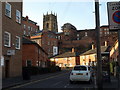
Leenside and the Lace Market
Leenside and the Lace Market from Canal Street, with a view of the tower of St. Mary's Church.
Image: © Andrew Abbott
Taken: 21 Mar 2010
0.01 miles
2
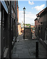
The top of Malin Hill
Sunlight and shadow on an August afternoon. Malin Hill is an ancient - and at its top end narrow - thoroughfare running diagonally down the face of the sandstone bluff on which The Lace Market (the centre of the Saxon burgh) stands.
Image: © John Sutton
Taken: 8 Aug 2016
0.01 miles
3
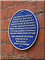
Plaque at top of Long Stairs
Sadly the gate at the top of Long Stairs leading from Commerce Square remains locked. Plaque is at top of Long Stairs just behind the gate on right wall as you look down. Hopefully at some point the Stairs can be fully open and the ancient right of way restored.
Image: © El Loco
Taken: 2 Jan 2021
0.01 miles
4
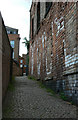
Malin Hill (2)
One of the pedestrian ways up into the Lace Market area. This is the upper end which still retains a traditional atmosphere. The building on the right would probably have been associated with the lace trade, but is now derelict. The white marks are not graffiti, but efflorescence from the brickwork.
Image: © Alan Murray-Rust
Taken: 17 May 2010
0.01 miles
5
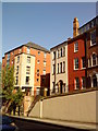
Buildings above Hollowstone, Nottingham
Image: © Andrew Abbott
Taken: 3 Jun 2010
0.01 miles
7
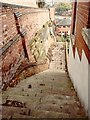
Long Stairs - old walkway (April 2015)
LONG STAIRS, now closed, which gave communication from Commerce-square, via Malin-hill (off High Pavement, opposite St. Mary’s Church to Narrow Marsh (later Red Lion-street and now Cliff-road), probably began life ages ago, long before the Romans came to Britain, as a covered way leading from the low ground or marshes along the Leen, to the summit of the cliff some 90 feet above it; upon which stood the primitive settlement that has developed into Nottingham.
Image: © John Beniston
Taken: 7 Apr 2015
0.01 miles
9
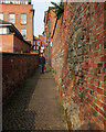
Up Malin Hill
A steep and ancient path up the face of the sandstone bluff on which Anglo-Saxon Nottingham developed. It leads from London Road to The Lace Market.
Image: © John Sutton
Taken: 11 Apr 2016
0.01 miles
10
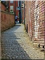
Malin Hill
A long-established alleyway leading up to the Lace Market area of the city.
Image: © Alan Murray-Rust
Taken: 26 May 2017
0.01 miles