Long Stairs - old walkway
Introduction
The photograph on this page of Long Stairs - old walkway by John Beniston as part of the Geograph project.
The Geograph project started in 2005 with the aim of publishing, organising and preserving representative images for every square kilometre of Great Britain, Ireland and the Isle of Man.

There are currently over 7.5m images from over 14,400 individuals and you can help contribute to the project by visiting https://www.geograph.org.uk
Long Stairs - old walkway
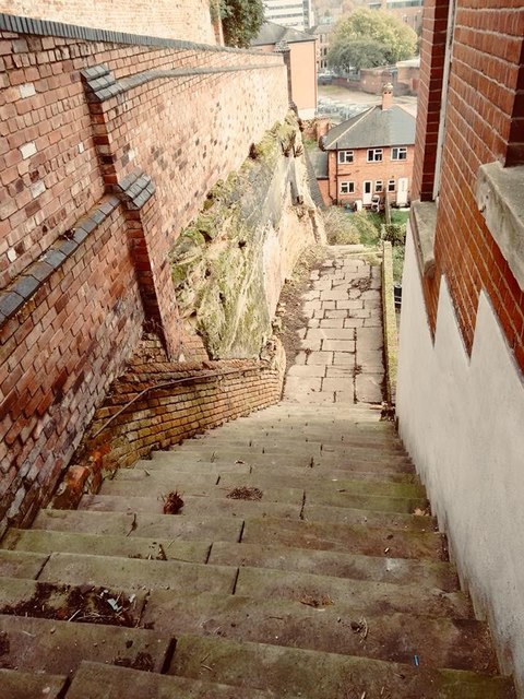
Image: © John Beniston Taken: 7 Apr 2015
LONG STAIRS, now closed, which gave communication from Commerce-square, via Malin-hill (oft High Pavement, opposite St. Mary’s Church to Narrow Marsh (later Red Lion-street and now Cliff-road), probably began life ages ago, long before the Romans came to Britain, as a covered way leading from the low ground or marshes along the Leen, to the summit of the cliff some 90 feet above it; upon which stood the primitive settlement that has developed into Nottingham.
Images are licensed for reuse under creativecommons.org/licenses/by-sa/2.0
Image Location
Latitude
52.950687
Longitude
-1.142664