
IMAGES TAKEN NEAR TO
Northfields, NOTTINGHAM, NG10 3FJ
Introduction
This page details the photographs taken nearby to Northfields, NG10 3FJ by members of the Geograph project.
The Geograph project started in 2005 with the aim of publishing, organising and preserving representative images for every square kilometre of Great Britain, Ireland and the Isle of Man.

There are currently over 7.5m images from over14,400 individuals and you can help contribute to the project by visiting https://www.geograph.org.uk
Image Map
Images are licensed for reuse under creativecommons.org/licenses/by-sa/2.0
Notes
- Clicking on the map will re-center to the selected point.
- The higher the marker number, the further away the image location is from the centre of the postcode.
Image Listing (14 Images Found)
Images are licensed for reuse under creativecommons.org/licenses/by-sa/2.0
Image
Details
Distance
1
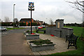
Sawley War Memorial
Commemoration of the fallen in the two World Wars and conflicts since.
Built in 2006.
See also http://www.geograph.org.uk/photo/1182975.
Image: © David Lally
Taken: 28 Feb 2009
0.17 miles
2

Sign for Sawley
This stands by the new Sawley War Memorial http://www.geograph.org.uk/photo/1182975.
The pictures show clockwise from the top left; Trent lock http://www.geograph.org.uk/photo/1090591, shire horses in a field, the railway bridge in New Sawley http://www.geograph.org.uk/photo/55101 and Sawley Church.
Image: © David Lally
Taken: 28 Feb 2009
0.17 miles
4
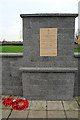
Sawley War Memorial
Built in 2006 see also http://www.geograph.org.uk/photo/1182242.
Still with poppy wreaths from last November.
Image: © David Lally
Taken: 28 Feb 2009
0.17 miles
6
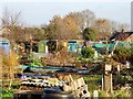
Wilmot Street Allotments
The allotments have been here since the 19th century and, therefore, pre-date Wilmot Street, which wasn't built 'til the mid-20th.
Image: © Ian Calderwood
Taken: 7 Dec 2016
0.21 miles
7
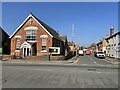
New Sawley Methodist church, Tamworth Road
Image: © Nigel Thompson
Taken: 26 Mar 2022
0.21 miles
9
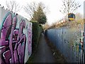
Footpath by the railway
This was originally a field path to Sawley but urbanisation and diversions have left it hemmed-in and subject to vandalism and anti-social behaviour.
Image: © Ian Calderwood
Taken: 7 Dec 2016
0.21 miles
10
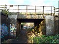
Railway bridge over a footpath
This was originally a farm access but the footpath was diverted this way to avoid a level crossing in the early 20th century.
Image: © Ian Calderwood
Taken: 7 Dec 2016
0.24 miles