IMAGES TAKEN NEAR TO
St. Oswalds Close, MORPETH, NE65 0WT
Introduction
This page details the photographs taken nearby to St. Oswalds Close, NE65 0WT by members of the Geograph project.
The Geograph project started in 2005 with the aim of publishing, organising and preserving representative images for every square kilometre of Great Britain, Ireland and the Isle of Man.

There are currently over 7.5m images from over14,400 individuals and you can help contribute to the project by visiting https://www.geograph.org.uk
Image Map (Loading...)


Getting Data...Please wait
Leaflet Map data © OpenStreetMap
Images are licensed for reuse under creativecommons.org/licenses/by-sa/2.0
Notes
- Clicking on the map will re-center to the selected point.
- The higher the marker number, the further away the image location is from the centre of the postcode.
Image Listing (10 Images Found)
Images are licensed for reuse under creativecommons.org/licenses/by-sa/2.0
Image
Details
Distance
1
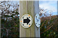
Waymark, St Oswald's Way
Direction sign at a road fork on the south side of Warkworth.
Image: © Jim Barton
Taken: 15 Mar 2022
0.07 miles
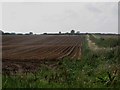
2
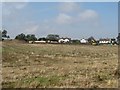
Arable field on the edge of Warkworth
An arable field on the edge of the village of Warkworth. On the far side of the field earth works appear to be taking place, this may be the preparation of a site for a housing development.
Image: © Graham Robson
Taken: 11 Sep 2015
0.07 miles
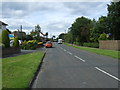
3

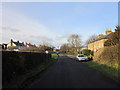
Outskirts of Warkworth
The southern fringe of Warkworth seen from the access road from New Barns.
Image: © Jim Barton
Taken: 15 Mar 2022
0.09 miles
5
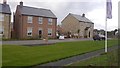
New houses, Guilden Road
The current southern edge of Warksworth.
Image: © Richard Webb
Taken: 15 Sep 2018
0.14 miles
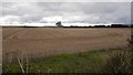
7
Arable field south of Warkworth
An arable field to the south of Warkworth which has a crop of potatoes in it. The tops of the plants have been killed off prior to the field being harvested.
Image: © Graham Robson
Taken: 11 Sep 2015
0.17 miles
8
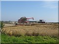
Harvesting wheat south of Warkworth
A Case Axial Flow combine harvester is working its way through a field of wheat at New Barns to the south of Warkworth.
Image: © Graham Robson
Taken: 11 Sep 2015
0.24 miles
9
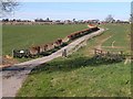
St Oswald's Way approaching Warkworth
St Oswald's Way http://www.stoswaldsway.com/home.html is a 156 Km long trail which runs from Heavenfield near Hexham to Holy Island on the Northumberland coast (although more commonly walked in the opposite direction). Here the Way follows the farm road from New Barn Farm (status bridleway) into Warkworth. The outskirts of Warkworth can be seen on the horizon.
Image: © Oliver Dixon
Taken: 12 Apr 2010
0.24 miles
10
Stubble, New Barns
Arable land just south of Warksworth.
Image: © Richard Webb
Taken: 15 Sep 2018
0.25 miles