
IMAGES TAKEN NEAR TO
Oxted Place, NEWCASTLE UPON TYNE, NE6 3RX
Introduction
This page details the photographs taken nearby to Oxted Place, NE6 3RX by members of the Geograph project.
The Geograph project started in 2005 with the aim of publishing, organising and preserving representative images for every square kilometre of Great Britain, Ireland and the Isle of Man.

There are currently over 7.5m images from over14,400 individuals and you can help contribute to the project by visiting https://www.geograph.org.uk
Image Map
Images are licensed for reuse under creativecommons.org/licenses/by-sa/2.0
Notes
- Clicking on the map will re-center to the selected point.
- The higher the marker number, the further away the image location is from the centre of the postcode.
Image Listing (34 Images Found)
Images are licensed for reuse under creativecommons.org/licenses/by-sa/2.0
Image
Details
Distance
1
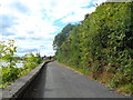
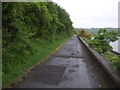
Hadrian's Wall Path by The River Tyne
Image: © Anthony Parkes
Taken: 29 Jul 2014
0.08 miles
2
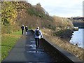
Walkers and joggers on Hadrian's Way west of St Anthony's Point
The River Tyne here flows through a rustic setting with well-wooded banks on either side.
The promenade carries Hadrian's Way which is a largely traffic-free route along the north side of the Tyne from western to eastern boundaries of the City of Newcastle-upon-Tyne. The Way is followed by both Hadrian's Wall National Trail http://www.nationaltrail.co.uk/hadrianswall/ and by route 72 of the National Cycle Network (Hadrian's Cycleway
http://www.cycle-routes.org/HADRIANSCYCLEWAY/and the Tynemouth branch of the C2C Cycle Route http://www.c2c-guide.co.uk/). The way is popular with walkers, joggers and cyclists.
Image: © Oliver Dixon
Taken: 18 Nov 2008
0.09 miles
3
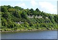
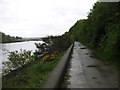
Hadrian's Wall Path
Running along the banks of the River Tyne.
This area has been recovered from industrial devastation,
a railway used to run at the top of the wall.
Image: © Russel Wills
Taken: 7 Aug 2014
0.09 miles
6
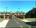
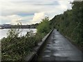
The Hadrian's Wall Path beside the River Tyne
Heading for the centre of Newcastle.
Image: © David Purchase
Taken: 24 May 2013
0.11 miles
7
Hadrian's Way
Part of the Hadrian's Wall National Trail passing along the leafy north bank of the Tyne through an area once full of industry. In the left background is the city of Newcastle, with St James' Park prominent on the skyline.
Image: © David Robinson
Taken: 24 Aug 2018
0.11 miles
10

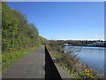
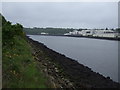
View downriver along Hadrian's Wall Path
At St Anthony's, Walker. The path here runs beside the River Tyne. On the far bank can be seen the large industrial site of International Paints on Felling Shore.
Image: © Robert Graham
Taken: 24 Jul 2013
0.11 miles