IMAGES TAKEN NEAR TO
Springfield Road, NEWCASTLE UPON TYNE, NE5 3DS
Introduction
This page details the photographs taken nearby to Springfield Road, NE5 3DS by members of the Geograph project.
The Geograph project started in 2005 with the aim of publishing, organising and preserving representative images for every square kilometre of Great Britain, Ireland and the Isle of Man.

There are currently over 7.5m images from over14,400 individuals and you can help contribute to the project by visiting https://www.geograph.org.uk
Image Map
Images are licensed for reuse under creativecommons.org/licenses/by-sa/2.0
Notes
- Clicking on the map will re-center to the selected point.
- The higher the marker number, the further away the image location is from the centre of the postcode.
Image Listing (15 Images Found)
Images are licensed for reuse under creativecommons.org/licenses/by-sa/2.0
Image
Details
Distance
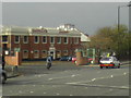
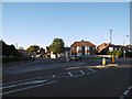
1
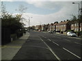
Springfield Road
The A696 links Ponteland Road with Silver Lonnen and the West Road.
Image: © MSX
Taken: 29 Oct 2005
0.04 miles
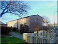
2
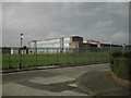
Blakelaw School
School making good in run down locality.
Image: © MSX
Taken: 29 Oct 2005
0.07 miles
3
Ponteland Road
This Road takes one to Newcastle Airport.
Image: © MSX
Taken: 29 Oct 2005
0.10 miles
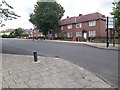
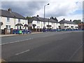
4
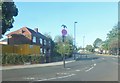
Eastern Way
Residential street in the northwestern suburbs of Newcastle.
Image: © Barbara Carr
Taken: 15 Sep 2013
0.12 miles
5
Red Brick Bakery
Great red-brick bakery on Ponteland Road. Carricks was usurped by Greggs and re-branded Bakers Oven.
Image: © MSX
Taken: 29 Oct 2005
0.13 miles
7
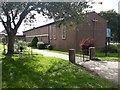
St Peter's Parish Church, Cowgate, Newcastle upon Tyne
The parish church dedicated to St Peter located on the corner of Ponteland Road and Druridge Drive in Cowgate.
Image: © Graham Robson
Taken: 6 Jul 2020
0.16 miles
8
Eastern Way, Cowgate, Newcastle upon Tyne
A residential street in the Cowgate area of Newcastle.
Image: © Graham Robson
Taken: 6 Jul 2020
0.17 miles
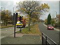
9
Springfield Road
Junction with Sunnyway.
Image: © Richard Webb
Taken: 1 Oct 2015
0.18 miles
10
Ponteland Road, Cowgate, Newcastle upon Tyne
Looking across Ponteland Road towards terraced houses on the eastern side of the road. The barriers on blocking off the pavement in front of the houses indicate that the cause for the work is the installation of new high speed broadband infrastructure.
Image: © Graham Robson
Taken: 6 Jul 2020
0.19 miles