IMAGES TAKEN NEAR TO
Allenheads, HEXHAM, NE47 9JE
Introduction
This page details the photographs taken nearby to NE47 9JE by members of the Geograph project.
The Geograph project started in 2005 with the aim of publishing, organising and preserving representative images for every square kilometre of Great Britain, Ireland and the Isle of Man.

There are currently over 7.5m images from over14,400 individuals and you can help contribute to the project by visiting https://www.geograph.org.uk
Image Map
Images are licensed for reuse under creativecommons.org/licenses/by-sa/2.0
Notes
- Clicking on the map will re-center to the selected point.
- The higher the marker number, the further away the image location is from the centre of the postcode.
Image Listing (40 Images Found)
Images are licensed for reuse under creativecommons.org/licenses/by-sa/2.0
Image
Details
Distance
1
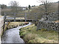
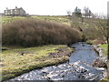
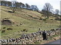
View SSW from B6295 near Dirt Pot
Over disused mine shafts, and the River East Allen at Dovespool.
Image: © Stanley Howe
Taken: 22 Aug 2013
0.09 miles
2
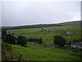
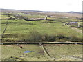
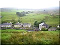
New House, Dirt Pot
Beyond is the ruined farmhouse above Blackcleugh Burn - see http://www.geograph.org.uk/search.php?i=70568399 . The location of the disused building can be seen in Image
Image: © Mike Quinn
Taken: 26 Mar 2017
0.10 miles
5
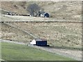
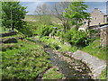
East Allen Dale near Dirt Pot
Image is on the horizon (right).
Image: © Mike Quinn
Taken: 11 Mar 2008
0.11 miles
9
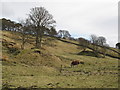
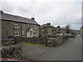
Dovespool, East Allendale
Seen from the B6295 near Dirt Pot.
Image: © Stanley Howe
Taken: 22 Aug 2013
0.12 miles