IMAGES TAKEN NEAR TO
New York Way, NEWCASTLE UPON TYNE, NE27 0QF
Introduction
This page details the photographs taken nearby to New York Way, NE27 0QF by members of the Geograph project.
The Geograph project started in 2005 with the aim of publishing, organising and preserving representative images for every square kilometre of Great Britain, Ireland and the Isle of Man.

There are currently over 7.5m images from over14,400 individuals and you can help contribute to the project by visiting https://www.geograph.org.uk
Image Map
Images are licensed for reuse under creativecommons.org/licenses/by-sa/2.0
Notes
- Clicking on the map will re-center to the selected point.
- The higher the marker number, the further away the image location is from the centre of the postcode.
Image Listing (16 Images Found)
Images are licensed for reuse under creativecommons.org/licenses/by-sa/2.0
Image
Details
Distance
1
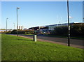
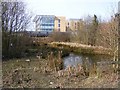
Silverlink Industrial Estate
One of the many new factories on the Silverlink Industrial Estate.
Image: © Weston Beggard
Taken: 13 Nov 2005
0.14 miles
2
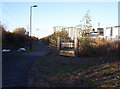
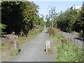
Disused Waggonway
One of the many waggonways in the area which has been reclaimed for use as a cycle track/footpath.
Image: © Weston Beggard
Taken: 13 Nov 2005
0.14 miles
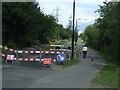
4
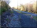
Cycle route on old railway
National Cycle Route 10, part of the Reiver's Cycle Route follows the line of the old Blyth and Tyne Railway and Seaton Burn Waggonway. A soft surface path alongside has been provided for horses.
Image: © Oliver Dixon
Taken: 4 Dec 2013
0.16 miles
5
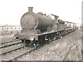
Wagonway north of Middle Engine Way
The Blyth and Tyne Railway which served Cramlington and Backworth Collieries is now a cycle/footpath. This is also the route of the older Seatonburn Waggonway.
The railway is shown as operational on the 1981 1:50,000 Ordnance Survey map.
Image: © Richard Webb
Taken: 1 Oct 2015
0.17 miles
10
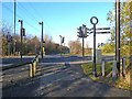
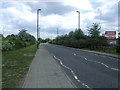
Toucan crossing on Middle Engine Lane
National Cycle Route 10, part of the Reiver's Cycle Route follows the line of the old Blyth and Tyne Railway and Seaton Burn Waggonway. A toucan crossing for cyclists and pedestrians has been provided where the route crosses Middle Engine Lane. A Pegasus crossing has been provided for horse-riders using the adjacent bridle path.
Image: © Oliver Dixon
Taken: 4 Dec 2013
0.20 miles