
IMAGES TAKEN NEAR TO
Melton Crescent, WHITLEY BAY, NE26 4DA
Introduction
This page details the photographs taken nearby to Melton Crescent, NE26 4DA by members of the Geograph project.
The Geograph project started in 2005 with the aim of publishing, organising and preserving representative images for every square kilometre of Great Britain, Ireland and the Isle of Man.

There are currently over 7.5m images from over14,400 individuals and you can help contribute to the project by visiting https://www.geograph.org.uk
Image Map
Images are licensed for reuse under creativecommons.org/licenses/by-sa/2.0
Notes
- Clicking on the map will re-center to the selected point.
- The higher the marker number, the further away the image location is from the centre of the postcode.
Image Listing (52 Images Found)
Images are licensed for reuse under creativecommons.org/licenses/by-sa/2.0
Image
Details
Distance
2
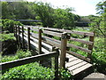
Footbridge over Seaton Burn, Holywell Dene
This footbridge stands close to the 'Normal Tide Level (NTL)', and at the cross-roads of three public footpaths. The bridge bears the black and white disc of the 'Tyne & Wear Heritage Way', an 80 mile route taking in the rich historic and industrial heritage of the area. The way is broken down into nine convenient sections that can be walked at any time, and in any order. In the background is a pipe bridge, carrying sewerage sludge, which has been a long-time feature of this part of the dene. For a selection of detailed free to download walking routes in the area visit www.northtynesidewalks.co.uk
Image: © Geoff Holland
Taken: 6 May 2020
0.10 miles
3
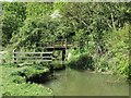
Footbridge over the Seaton Burn, Holywell Dene
This is the same footbridge as is shown at https://www.geograph.org.uk/photo/6465676 but viewed from the opposite bank of the burn and slightly upstream. When the first Ordnance Survey Six-Inch map of the area was published in 1865, a wooden viaduct crossed the burn at this point and it is quite conceivable that the old stonework, beneath both ends of the bridge, formed part of the viaduct support system. The viaduct carried a waggonway, a branch of the Blyth & Tyne Railway, which stretched from Hartley Pit to Seaton Sluice, serving both the Hartley Bottle Works and the nearby Iron Works. For a selection of detailed free to download walking routes in the area visit www.northtynesidewalks.co.uk
Image: © Geoff Holland
Taken: 6 May 2020
0.10 miles
4

Common Ragwort, Holywell Dene
A renowned 'weed' of paddocks, pastures and waste ground, the yellow flower heads of the Common Ragwort are highly attractive to bees and other insects, including the cinnabar moth. For a selection of detailed free to download walking routes in the area visit www.northtynesidewalks.co.uk
Image: © Geoff Holland
Taken: 11 Aug 2020
0.10 miles
5
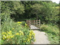
Footbridge over the Seaton Burn, Holywell Dene
This footbridge, which is the same bridge as is shown at https://www.geograph.org.uk/photo/6465676 but viewed from the opposite side, crosses the Seaton Burn close to the 'Normal Tide Level (NTL)', and at the cross-roads of three public footpaths. The bridge bears the black and white disc of the 'Tyne & Wear Heritage Way', an 80 mile route taking in the rich historic and industrial heritage of the area. The way is broken down into nine convenient sections that can be walked at any time, and in any order. For a selection of detailed free to download walking routes in the area visit www.northtynesidewalks.co.uk
Image: © Geoff Holland
Taken: 11 Aug 2020
0.11 miles
6
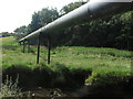
Pipe Bridge, Holywell Dene
This pipe bridge, which carries sewerage sludge, has been a long-time feature of this part of the dene. Very close to this point a waggonway, which stretched from Hartley Pit to Seaton Sluice and served both the Hartley Bottle Works and the nearby Iron Works, once crossed the Seaton Burn over a wooden viaduct. For a selection of detailed free to download walking routes in the area visit www.northtynesidewalks.co.uk
Image: © Geoff Holland
Taken: 11 Aug 2020
0.12 miles
7
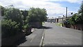
Dereham Road, Hartley
Residential area south of Seaton Sluice.
Image: © Richard Webb
Taken: 31 Jul 2012
0.12 miles
8

Simonside Close at Hartley
Housing estate at Hartley, south of Seaton Sluice.
Image: © Robert Graham
Taken: 3 Oct 2012
0.12 miles
9

Pipe Bridge, Holywell Dene
This is one of two pipe bridges that cross the Seaton Burn in this part of Holywell Dene. Fairly well-screened by the surrounding woodland, this pipe line carries sewage sludge. For a selection of detailed free to download walking routes in the area visit www.northtynesidewalks.co.uk
Image: © Geoff Holland
Taken: 6 May 2020
0.12 miles
10
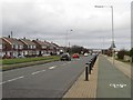
Beresford Road, Seaton Sluice
Looking north along the main road through Seaton Sluice. A cycle lane follows the side of the road closest to the sea.
Image: © Graham Robson
Taken: 20 Feb 2016
0.13 miles