Footbridge over the Seaton Burn, Holywell Dene
Introduction
The photograph on this page of Footbridge over the Seaton Burn, Holywell Dene by Geoff Holland as part of the Geograph project.
The Geograph project started in 2005 with the aim of publishing, organising and preserving representative images for every square kilometre of Great Britain, Ireland and the Isle of Man.

There are currently over 7.5m images from over 14,400 individuals and you can help contribute to the project by visiting https://www.geograph.org.uk
Footbridge over the Seaton Burn, Holywell Dene
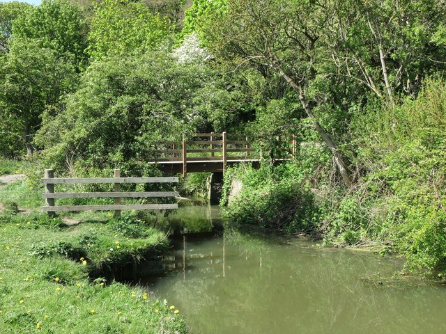
Image: © Geoff Holland Taken: 6 May 2020
This is the same footbridge as is shown at https://www.geograph.org.uk/photo/6465676 but viewed from the opposite bank of the burn and slightly upstream. When the first Ordnance Survey Six-Inch map of the area was published in 1865, a wooden viaduct crossed the burn at this point and it is quite conceivable that the old stonework, beneath both ends of the bridge, formed part of the viaduct support system. The viaduct carried a waggonway, a branch of the Blyth & Tyne Railway, which stretched from Hartley Pit to Seaton Sluice, serving both the Hartley Bottle Works and the nearby Iron Works. For a selection of detailed free to download walking routes in the area visit www.northtynesidewalks.co.uk
Images are licensed for reuse under creativecommons.org/licenses/by-sa/2.0
Image Location
Latitude
55.077682
Longitude
-1.475117