Footbridge over the Seaton Burn, Holywell Dene
Introduction
The photograph on this page of Footbridge over the Seaton Burn, Holywell Dene by Geoff Holland as part of the Geograph project.
The Geograph project started in 2005 with the aim of publishing, organising and preserving representative images for every square kilometre of Great Britain, Ireland and the Isle of Man.

There are currently over 7.5m images from over 14,400 individuals and you can help contribute to the project by visiting https://www.geograph.org.uk
Footbridge over the Seaton Burn, Holywell Dene
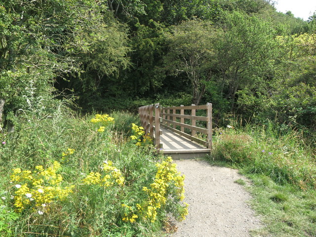
Image: © Geoff Holland Taken: 11 Aug 2020
This footbridge, which is the same bridge as is shown at https://www.geograph.org.uk/photo/6465676 but viewed from the opposite side, crosses the Seaton Burn close to the 'Normal Tide Level (NTL)', and at the cross-roads of three public footpaths. The bridge bears the black and white disc of the 'Tyne & Wear Heritage Way', an 80 mile route taking in the rich historic and industrial heritage of the area. The way is broken down into nine convenient sections that can be walked at any time, and in any order. For a selection of detailed free to download walking routes in the area visit www.northtynesidewalks.co.uk
Images are licensed for reuse under creativecommons.org/licenses/by-sa/2.0
Image Location
Latitude
55.077593
Longitude
-1.475275