
IMAGES TAKEN NEAR TO
Claremont Road, WHITLEY BAY, NE26 3TX
Introduction
This page details the photographs taken nearby to Claremont Road, NE26 3TX by members of the Geograph project.
The Geograph project started in 2005 with the aim of publishing, organising and preserving representative images for every square kilometre of Great Britain, Ireland and the Isle of Man.

There are currently over 7.5m images from over14,400 individuals and you can help contribute to the project by visiting https://www.geograph.org.uk
Image Map
Images are licensed for reuse under creativecommons.org/licenses/by-sa/2.0
Notes
- Clicking on the map will re-center to the selected point.
- The higher the marker number, the further away the image location is from the centre of the postcode.
Image Listing (20 Images Found)
Images are licensed for reuse under creativecommons.org/licenses/by-sa/2.0
Image
Details
Distance
1
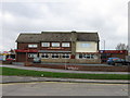
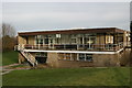
Kittiwake, Claremont Road, Whitley Bay
A Public House
Image: © Alex McGregor
Taken: 8 Apr 2010
0.07 miles
2
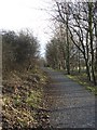
Tree Lined Footpath
This path runs through a modern housing estate but still retains a sense of peace and beauty
Image: © Christine Westerback
Taken: 14 Jan 2006
0.09 miles
6
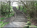
Public Footpath and Stairs
These stairs appear to follow the course of the map shown public footpath leading to and from the Brierdene Burn. For a selection of detailed free to download walking routes in the area visit www.northtynesidewalks.co.uk
Image: © Geoff Holland
Taken: 5 Apr 2020
0.12 miles
7
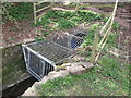
Culvert on Brierdene Burn
This small steel cage prevents unauthorised access to the culvert through which the Brierdene Burn flows from the opposite side of Astley Drive. For a selection of detailed free to download walking routes in the area visit www.northtynesidewalks.co.uk
Image: © Geoff Holland
Taken: 5 Apr 2020
0.12 miles
8
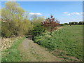
Footpath, Brierdene, Whitley Bay
This footpath descends from the large grassy area above the Brierdene Burn to the burn itself and is one of a number of such access points. This whole area was previously part of Whitley Bay Golf Links, as shown on the 1920 Ordnance Survey Six-Inch map of the area, and is now the Brierdene Wildlife Site. The site is managed by the Friends of Brierdene, with assistance from North Tyneside Council, and contains some 327 species of trees, wild flowers, grasses and herbs. In total some 126 species of birds, 21 species of butterfly, 15 species of bumblebees and 165 different species of moths have at some time been seen here. For a selection of detailed free to download walking routes in the area visit www.northtynesidewalks.co.uk
Image: © Geoff Holland
Taken: 11 Apr 2020
0.14 miles
9
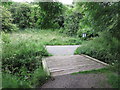
Bridge over the Brierdene Burn, Whitley Bay
This is the highest of six small bridges which cross the Brierdene Burn as it passes through the Brierdene an area which is managed by Friends of Brierdene see www.friendsofbrierdene.org.uk with assistance from North Tyneside Council. For a selection of detailed free to download walking routes in the area visit www.northtynesidewalks.co.uk
Image: © Geoff Holland
Taken: 5 Jul 2019
0.14 miles
10

Bridge over the Brierdene Burn, Whitley Bay
This is the second highest of six small bridges which cross the Brierdene Burn as it passes through the Brierdene an area which is managed by Friends of Brierdene see www.friendsofbrierdene.org.uk with assistance from North Tyneside Council. For a selection of detailed free to download walking routes in the area visit www.northtynesidewalks.co.uk
Image: © Geoff Holland
Taken: 5 Jul 2019
0.14 miles