
IMAGES TAKEN NEAR TO
Fir Terrace, NEWCASTLE UPON TYNE, NE16 6DP
Introduction
This page details the photographs taken nearby to Fir Terrace, NE16 6DP by members of the Geograph project.
The Geograph project started in 2005 with the aim of publishing, organising and preserving representative images for every square kilometre of Great Britain, Ireland and the Isle of Man.

There are currently over 7.5m images from over14,400 individuals and you can help contribute to the project by visiting https://www.geograph.org.uk
Image Map
Images are licensed for reuse under creativecommons.org/licenses/by-sa/2.0
Notes
- Clicking on the map will re-center to the selected point.
- The higher the marker number, the further away the image location is from the centre of the postcode.
Image Listing (14 Images Found)
Images are licensed for reuse under creativecommons.org/licenses/by-sa/2.0
Image
Details
Distance
1
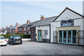
The Joinery at Crookgate Bank
The Joinery is a café on the east side of the A692 at Crookgate Bank which appears to be an ex-council housing estate, adjacent to Burnopfield.
Image: © Trevor Littlewood
Taken: 18 Apr 2019
0.04 miles
3
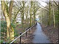
Ramp down to Front Street, Burnopfield
This path forms part of Regional Route 11 of the National Cycle Network, which for the most part follows the trackbed of the old Bowes Railway.
Over this section it appears to have diverged from the line of the railway and drops steeply down to Front Street, Burnopfield where it terminates (at least for the present). The path reappears at Causey from where it runs east towards Jarrow.
Image: © Oliver Dixon
Taken: 28 Feb 2014
0.14 miles
4
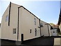
Farmhouse at Crookfield Farm
This farm is shown on the 1862 Ordnance Survey First Series map. Although much modified, this is probably the original farmhouse.
Image: © Robert Graham
Taken: 14 May 2014
0.16 miles
5
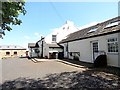
Crookfield Farm
This old farm stands beside the A692 at the top of Crookgate Bank, near Burnopfield. It dates back to the early C19. A lot of the outbuildings have been converted to residential.
Image: © Robert Graham
Taken: 14 May 2014
0.17 miles
6
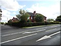
Bowesville, Crookgate
Housing estate in Crookgate, a village near Burnopfield. It gets its name from the former coalowners, the Bowes family.
Image: © Robert Graham
Taken: 8 Aug 2012
0.17 miles
7
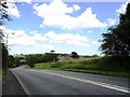
Top of Crookgate Bank
Looking down the bank towards the junction with the road from Burnopfield. This can be a tricky spot on bad winter weather.
Image: © Robert Graham
Taken: 8 Aug 2012
0.17 miles
8
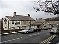
The Burton House
This is Watson Street in Burnopfield, which leads off Front Street. The pub must take its name from the famous ales brewed in the Staffordshire town of that name.
Image: © Robert Graham
Taken: 27 Mar 2013
0.18 miles
10
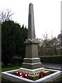
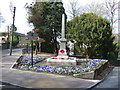
War Memorial, Burnopfield
A simple monument in pristine condition; obviously well cared for.
Image: © Alan Fearon
Taken: 6 Feb 2006
0.19 miles