
IMAGES TAKEN NEAR TO
Busty Bank, NEWCASTLE UPON TYNE, NE16 6BQ
Introduction
This page details the photographs taken nearby to Busty Bank, NE16 6BQ by members of the Geograph project.
The Geograph project started in 2005 with the aim of publishing, organising and preserving representative images for every square kilometre of Great Britain, Ireland and the Isle of Man.

There are currently over 7.5m images from over14,400 individuals and you can help contribute to the project by visiting https://www.geograph.org.uk
Image Map
Images are licensed for reuse under creativecommons.org/licenses/by-sa/2.0
Notes
- Clicking on the map will re-center to the selected point.
- The higher the marker number, the further away the image location is from the centre of the postcode.
Image Listing (23 Images Found)
Images are licensed for reuse under creativecommons.org/licenses/by-sa/2.0
Image
Details
Distance
1
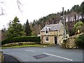
Cottage on Busty Bank
This little cottage is the first house you come across as you come up Busty Bank from Rowlands Gill to the village of Burnopfield. This area of the village is the oldest part, and some of the houses, perhaps including this one, date back to the 18th century. The village was greatly expanded in the 19th century with the increase in coal mining in the area.
Image: © Robert Graham
Taken: 27 Mar 2013
0.05 miles
2
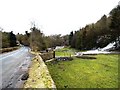
Leap Mill Farm
This farm in a very picturesque setting just to the north of Burnopfield village, dates to the 18th century. The mill beside the farm was operated by a waterwheel.
Image: © Robert Graham
Taken: 27 Mar 2013
0.08 miles
3
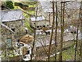
Farmyard at Leap Mill
View of the yard at Leap Mill Farm from Busty Bank. The farmer seems to be mucking out the stables. There is a very fine cockerel on the muck heap, if you zoom in. The farm with its attached watermill dates to the 18th century.
Image: © Robert Graham
Taken: 27 Mar 2013
0.08 miles
4
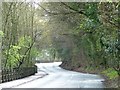
New Road, above Busty Bank
The B6314 heading up to Burnopfield.
Image: © Christine Johnstone
Taken: 12 Apr 2012
0.10 miles
5
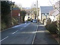
Busty Bank, Burnopfield
A steep winding street which drops down the south side of the Derwent valley.
Image: © Oliver Dixon
Taken: 28 Feb 2014
0.11 miles
6
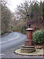
Roadside Pant
On the B6314 near the end of its climb into Burnopfield, this fountain (with electric light!) was erected in 1905 in memory of a respected local resident, known especially for his "kindness to dumb animals".
Image: © Alan Fearon
Taken: 6 Feb 2006
0.14 miles
7
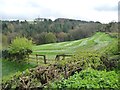
Mown field above Leapmill Burn
Unusual to see a mown field in April, but I think it is related to the re-introduction of red kites locally.
Image: © Christine Johnstone
Taken: 12 Apr 2012
0.18 miles
8
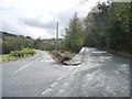
Two ways to Burnopfield
Busty Bank to the left, New Road to the right.
Image: © Christine Johnstone
Taken: 12 Apr 2012
0.18 miles
9
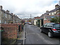
Back lane between Front Street and Park View
Wide enough to park cars in.
Image: © Christine Johnstone
Taken: 12 Apr 2012
0.19 miles
10
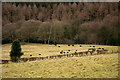
Woodland and field with sheep
The woodland is the southern end of West Wood which appears to be part of the National Trust's Gibside Estate.
Image: © Trevor Littlewood
Taken: 12 Jan 2017
0.20 miles