
IMAGES TAKEN NEAR TO
Burnopfield, NEWCASTLE UPON TYNE, NE16 6AG
Introduction
This page details the photographs taken nearby to NE16 6AG by members of the Geograph project.
The Geograph project started in 2005 with the aim of publishing, organising and preserving representative images for every square kilometre of Great Britain, Ireland and the Isle of Man.

There are currently over 7.5m images from over14,400 individuals and you can help contribute to the project by visiting https://www.geograph.org.uk
Image Map
Images are licensed for reuse under creativecommons.org/licenses/by-sa/2.0
Notes
- Clicking on the map will re-center to the selected point.
- The higher the marker number, the further away the image location is from the centre of the postcode.
Image Listing (19 Images Found)
Images are licensed for reuse under creativecommons.org/licenses/by-sa/2.0
Image
Details
Distance
1
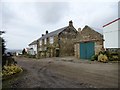
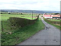
Toft Gate farmhouse, Burnopfield
Located off Syke Road, at the western end of the village. The farmhouse is shown in this position on the 1862 Ordnance Survey First Series map and is probably early 19th century.
Image: © Robert Graham
Taken: 5 Mar 2014
0.01 miles
6
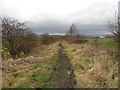
Old wagonway
This former wagonway led down to the Linz colliery, part of an extensive network of such ways in the area. Toft Farm on the right.
Image: © Robert Graham
Taken: 9 Mar 2012
0.10 miles
7
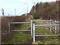
Foot- and cycle-path alongside Syke Road
This path forms part of Regional Route 11 of the National Cycle Network, which for the most part follows the trackbed of the old Bowes Railway.
Over this section it appears to have diverged from the line of the railway and runs behind the hedgerow parallel to the busy Syke Road.
Image: © Oliver Dixon
Taken: 28 Feb 2014
0.12 miles
8
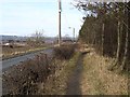
Bowes Railway Path at Burnopfield
This path forms part of Regional Route 11 of the National Cycle Network, which for the most part follows the trackbed of the old Bowes Railway. At present, much of the path is of poor standard, only suitable for mountain bikes.
Over this section it appears to have diverged from the line of the railway and runs closely parallel to Syke Road before diverging into woodland.
Image: © Oliver Dixon
Taken: 28 Feb 2014
0.15 miles
9
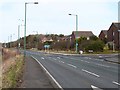
Shared-use path crossing of Syke Road
This shared-use path forms part of Regional Route 11 of the National Cycle Network, which for the most part follows the trackbed of the old Bowes Railway.
Over this section it appears to have diverged from the line of the railway and runs along the footway of the busy Syke Road, crossing to the east side by this refuge near the junction with the Meadows.
Image: © Oliver Dixon
Taken: 28 Feb 2014
0.16 miles
10
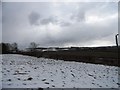
View SW from beside Syke Road
View from just above this road leading from the Linz at Burnopfield to Pickering Nook, across a snowy landscape. Pontop Pike with its TV mast is visible in the centre distance.
Image: © Robert Graham
Taken: 27 Mar 2013
0.19 miles