1
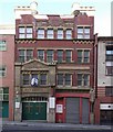
An evening view of The Bogeda Pub
In Westgate Street, Newcastle.
Image: © John Lucas
Taken: 16 Aug 2016
0.01 miles
2
Former Salvation Army Temple
On Westgate Road in Newcastle city centre. This was built in 1890 and inside is an auditorium that could hold 3000 people. It was built to resemble a music hall to attract people. Unfortunately, it closed in 2008 and, as can be seen, is still empty.
Image: © Robert Graham
Taken: 13 Nov 2019
0.01 miles
3
'The Bodega', Westgate Road
Formerly the 'Black Bull Inn'. A wonderful traditional style pub which retains many Victorian features and carries an excellent range of real ales. It is of particular interest to me because my 3x great grandfather, Thomas Dixon, operated a brewery here in the 1840s/50s.
(But, for the record, I now have no connection with the establishment and am just commenting on what I observed)
Image: © John Lucas
Taken: 15 Aug 2016
0.01 miles
4
The former Salvation Army City Temple, Westgate Road, NE1
Image: © Mike Quinn
Taken: 24 May 2010
0.02 miles
5
Former Salvation Army City Temple, Westgate Road
Closed in 2008 due to cost of upkeep after nearly 120 years. Read some of its history here http://www.chroniclelive.co.uk/north-east-news/history-newcastle-north-east/remember-when/2008/10/22/on-the-march-after-120-years-72703-22083898/
Image: © Andrew Curtis
Taken: 8 Mar 2010
0.02 miles
6
Bottom end of Bath Lane
In the west end of Newcastle city centre. This is the southern end of Bath Lane where it joins Westgate Road. Running along the right hand side of the street is a long section of the original 13th century town walls of Newcastle. On the left is the striking abstract sculpture "Ever Changing", by Ellis O'Connell, 2005. This was commissioned as part of the Grainger Town Project, when this area of the city was revamped. The sculpture occupies the site of the now demolished Waterloo pub.
Image: © Robert Graham
Taken: 27 Aug 2019
0.02 miles
7
The Bodega, 125 Westgate Road, NE1
Built c 1872; refurbished in 1906; and extended in 1937. The rebuild of the old Black Bull in 1872 included a shop space as well as the public house; they were combined in 1893. The plain red brickwork is enlivened by stone window surrounds, decorative stone trim to the eaves, and alternate red and cream stone over the first floor windows. The building is not listed.
The Buildings of Grainger Town - No.169. See
Image
Image: © Mike Quinn
Taken: 28 Aug 2013
0.02 miles
8
Rutherford Street, Newcastle
Image: © Roger Cornfoot
Taken: 9 Feb 2010
0.02 miles
9
The Bodega
The Bodega public house on Westgate Road.
Image: © Peter McDermott
Taken: 6 Jan 2008
0.02 miles
10
Westgate Road, Newcastle
Looking west in the evening sunshine.
Image: © John Lucas
Taken: 15 Aug 2016
0.02 miles


